Maní, Yucatán
Template:Short description Template:More citations needed Template:Use dmy dates Template:Main other{{#invoke:Infobox|infobox}}Template:Template other{{#invoke:Check for unknown parameters|check|unknown=Template:Main other|preview = Page using [[Template:Template:If empty]] with unknown parameter "_VALUE_"|ignoreblank=y|mapframe_args=y | alt | anthem | anthem_link | area_blank1_acre | area_blank1_dunam | area_blank1_ha | area_blank1_km2 | area_blank1_sq_mi | area_blank1_title | area_blank2_acre | area_blank2_dunam | area_blank2_ha | area_blank2_km2 | area_blank2_sq_mi | area_blank2_title | area_code | area_code_type | area_codes | area_footnotes | area_land_acre | area_land_dunam | area_land_ha | area_land_km2 | area_land_sq_mi | area_metro_acre | area_metro_dunam | area_metro_footnotes | area_metro_ha | area_metro_km2 | area_metro_sq_mi | area_note | area_rank | area_rural_acre | area_rural_dunam | area_rural_footnotes | area_rural_ha | area_rural_km2 | area_rural_sq_mi | area_total_acre | area_total_dunam | area_total_ha | area_total_km2 | area_total_sq_mi | area_urban_acre | area_urban_dunam | area_urban_footnotes | area_urban_ha | area_urban_km2 | area_urban_sq_mi | area_water_acre | area_water_dunam | area_water_ha | area_water_km2 | area_water_percent | area_water_sq_mi | blank_emblem_alt | blank_emblem_link | blank_emblem_size | blank_emblem_type | blank_emblem_sizedefault | blank_emblem_upright | blank_info | blank_info_sec1 | blank_info_sec2 | blank_name | blank_name_sec1 | blank_name_sec2 | blank1_info | blank1_info_sec1 | blank1_info_sec2 | blank1_name | blank1_name_sec1 | blank1_name_sec2 | blank2_info | blank2_info_sec1 | blank2_info_sec2 | blank2_name | blank2_name_sec1 | blank2_name_sec2 | blank3_info | blank3_info_sec1 | blank3_info_sec2 | blank3_name | blank3_name_sec1 | blank3_name_sec2 | blank4_info | blank4_info_sec1 | blank4_info_sec2 | blank4_name | blank4_name_sec1 | blank4_name_sec2 | blank5_info | blank5_info_sec1 | blank5_info_sec2 | blank5_name | blank5_name_sec1 | blank5_name_sec2 | blank6_info | blank6_info_sec1 | blank6_info_sec2 | blank6_name | blank6_name_sec1 | blank6_name_sec2 | blank7_info | blank7_info_sec1 | blank7_info_sec2 | blank7_name | blank7_name_sec1 | blank7_name_sec2 | caption | code1_info | code1_name | code2_info | code2_name | coor_pinpoint | coor_type | coordinates | coordinates_footnotes | demographics_type1 | demographics_type2 | demographics1_footnotes | demographics1_info1 | demographics1_info10 | demographics1_info2 | demographics1_info3 | demographics1_info4 | demographics1_info5 | demographics1_info6 | demographics1_info7 | demographics1_info8 | demographics1_info9 | demographics1_title1 | demographics1_title10 | demographics1_title2 | demographics1_title3 | demographics1_title4 | demographics1_title5 | demographics1_title6 | demographics1_title7 | demographics1_title8 | demographics1_title9 | demographics2_footnotes | demographics2_info1 | demographics2_info10 | demographics2_info2 | demographics2_info3 | demographics2_info4 | demographics2_info5 | demographics2_info6 | demographics2_info7 | demographics2_info8 | demographics2_info9 | demographics2_title1 | demographics2_title10 | demographics2_title2 | demographics2_title3 | demographics2_title4 | demographics2_title5 | demographics2_title6 | demographics2_title7 | demographics2_title8 | demographics2_title9 | dimensions_footnotes | dunam_link | elevation_footnotes | elevation_ft | elevation_link | elevation_m | elevation_max_footnotes | elevation_max_ft | elevation_max_m | elevation_max_point | elevation_max_rank | elevation_min_footnotes | elevation_min_ft | elevation_min_m | elevation_min_point | elevation_min_rank | elevation_point | embed | established_date | established_date1 | established_date2 | established_date3 | established_date4 | established_date5 | established_date6 | established_date7 | established_title | established_title1 | established_title2 | established_title3 | established_title4 | established_title5 | established_title6 | established_title7 | etymology | extinct_date | extinct_title | flag_alt | flag_border | flag_link | flag_size | footnotes | founder | geocode | governing_body | government_footnotes | government_type | government_blank1_title | government_blank1 | government_blank2_title | government_blank2 | government_blank2_title | government_blank3 | government_blank3_title | government_blank3 | government_blank4_title | government_blank4 | government_blank5_title | government_blank5 | government_blank6_title | government_blank6 | grid_name | grid_position | image_alt | image_blank_emblem | image_caption | image_flag | image_map | image_map1 | image_seal | image_shield | image_size | image_skyline | imagesize | image_sizedefault | image_upright | iso_code | leader_name | leader_name1 | leader_name2 | leader_name3 | leader_name4 | leader_name5 | leader_party | leader_title | leader_title1 | leader_title2 | leader_title3 | leader_title4 | leader_title5 | length_km | length_mi | map_alt | map_alt1 | map_caption | map_caption1 | mapsize | mapsize1 | module | motto | motto_link | mottoes | name | named_for | native_name | native_name_lang | nickname | nickname_link | nicknames | official_name | other_name | p1 | p10 | p11 | p12 | p13 | p14 | p15 | p16 | p17 | p18 | p19 | p2 | p20 | p21 | p22 | p23 | p24 | p25 | p26 | p27 | p28 | p29 | p3 | p30 | p31 | p32 | p33 | p34 | p35 | p36 | p37 | p38 | p39 | p4 | p40 | p41 | p42 | p43 | p44 | p45 | p46 | p47 | p48 | p49 | p5 | p50 | p6 | p7 | p8 | p9 | parts | parts_style | parts_type | pop_est_as_of | pop_est_footnotes | population | population_as_of | population_blank1 | population_blank1_footnotes | population_blank1_title | population_blank2 | population_blank2_footnotes | population_blank2_title | population_demonym | population_demonyms | population_density_blank1_km2 | population_density_blank1_sq_mi | population_density_blank2_km2 | population_density_blank2_sq_mi | population_density_km2 | population_density_metro_km2 | population_density_metro_sq_mi | population_density_rank | population_density_rural_km2 | population_density_rural_sq_mi | population_density_sq_mi | population_density_urban_km2 | population_density_urban_sq_mi | population_est | population_footnotes | population_metro | population_metro_footnotes | population_note | population_rank | population_rural | population_rural_footnotes | population_total | population_urban | population_urban_footnotes | postal_code | postal_code_type | postal2_code | postal2_code_type | pushpin_image | pushpin_label | pushpin_label_position | pushpin_map | pushpin_map_alt | pushpin_map_caption | pushpin_map_caption_notsmall | pushpin_map_narrow | pushpin_mapsize | pushpin_outside | pushpin_overlay | pushpin_relief | registration_plate | registration_plate_type | seal_alt | seal_link | seal_size | seal_type | seat | seat_type | seat1 | seat1_type | seat2 | seat2_type | settlement_type | shield_alt | shield_link | shield_size | short_description | subdivision_name | subdivision_name1 | subdivision_name2 | subdivision_name3 | subdivision_name4 | subdivision_name5 | subdivision_name6 | subdivision_type | subdivision_type1 | subdivision_type2 | subdivision_type3 | subdivision_type4 | subdivision_type5 | subdivision_type6 | template_name | timezone | timezone_DST | timezone_link | timezone1 | timezone1_DST | timezone1_location | timezone2 | timezone2_DST | timezone2_location | timezone3 | timezone3_DST | timezone3_location | timezone4 | timezone4_DST | timezone4_location | timezone5 | timezone5_DST | timezone5_location | total_type | translit_lang1 | translit_lang1_info | translit_lang1_info1 | translit_lang1_info2 | translit_lang1_info3 | translit_lang1_info4 | translit_lang1_info5 | translit_lang1_info6 | translit_lang1_type | translit_lang1_type1 | translit_lang1_type2 | translit_lang1_type3 | translit_lang1_type4 | translit_lang1_type5 | translit_lang1_type6 | translit_lang2 | translit_lang2_info | translit_lang2_info1 | translit_lang2_info2 | translit_lang2_info3 | translit_lang2_info4 | translit_lang2_info5 | translit_lang2_info6 | translit_lang2_type | translit_lang2_type1 | translit_lang2_type2 | translit_lang2_type3 | translit_lang2_type4 | translit_lang2_type5 | translit_lang2_type6 | type | unit_pref | utc_offset | utc_offset_DST | utc_offset1 | utc_offset1_DST | utc_offset2 | utc_offset2_DST | utc_offset3 | utc_offset3_DST | utc_offset4 | utc_offset4_DST | utc_offset5 | utc_offset5_DST | website | width_km | width_mi }}{{#invoke:Check for clobbered parameters|check | template = [[Template:Template:If empty]] | cat = Template:Main other | population; population_total | image_size; imagesize | image_alt; alt | image_caption; caption | settlement_type; type | utc_offset1; utc_offset | timezone1; timezone }}{{#if:
|
}}Template:Main other{{#ifexpr:{{#invoke:ParameterCount|main|mapframe|image_map|image_map1|pushpin_map}} >2 |Template:Main other}} Maní is a small city in Maní Municipality in the central region of the Yucatán Peninsula, in the Mexican state of Yucatán. It is about 100 km to the south south-east of Mérida, Yucatán, some 16 km east of Ticul. The village of Tipikal lies 6 km to the east.<ref name=Lougheed>Lougheed.</ref>
The population is around 4000.<ref name=INEGI/>
History
Maní's four millennium<ref name=Lougheed/> existence historically involves mostly its early Maya period, followed in recent centuries by its Spanish conquistador and religious period. Its Mexican period beginning over a century ago involved conflict.
Early history
Maní has been continuously occupied for approximately 4000 years.<ref name=Lougheed/> In the postclassic Mesoamerican era it was home to the Tutul-Xiu Maya<ref name=Lougheed/> dynasty, which moved their capital here from Uxmal in the 13th century. The Xiu were the dominant power in the western Yucatán after the fall of Mayapan in 1441.<ref>Solís.</ref> Maní served as the main religious center in honor of the deity Kukulcan (Cukulcan, Topiltzin Quetzalcoatl)<ref>Bancroft, p. 699.</ref><ref>Nicholson.</ref> for the Maya with an annual chic kaban<ref>Bancroft, p. 700.</ref> festival until 1341.<ref>Sharer, p. 552.</ref>
With the arrival of the Spanish the Xiu of Maní allied themselves with the Spanish and assisted in the conquest of the rest of the peninsula.<ref>Clendinnen, Cost, p. 98.</ref>
Maya book burning
On 12 July 1562,<ref name=ISO2.4>Nimoy, In Search Of...</ref> Friar Diego de Landa, who held the office of inquisitor before the Monastery of San Miguel Arcángel, held an auto de fe Inquisitional ceremony in Maní, burning a number of Maya hieroglyphic books and a reported 5000 idols, saying that they were "works of the devil".<ref name=ISO2.4/> The number of books burned is disputed. Landa claimed only burning 27. This act and numerous incidents of torture at the monastery were used to speed the mass adoption of Roman Catholicism throughout the region.
Landa's burning of these sacred books with Mayan writing and the subsequent reaction were described by him as follows:<ref name=Clen70/> Template:Quotation
Guerra de Castas
.jpg)
Maní was involved in part of the multi-decade conflict in the Guerra de Castas, the Caste War of the Yucatán. An engraved stone narrates an episode of the event for Maní in 1850.
Population
Template:Historical populations
Photo gallery
-
 1557 map of a portion of Yucatan centered on the town of Mani. Uxmal is marked by a stylized Maya temple.
 -
 Maní, Yucatán, in 1890
 -
 Municipal Palace of Maní, in 2016
 -
 House in the Main Square
 -
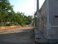 A street
 -
 An arch at the Church
 -
 An Inscription at the Church
 -
San Miguel Arcangel, Mani
-
 Sign about the burning of Mayan codices in Maní


See also
Notes
<references group=note/>
Citations
References
English
- Bancroft, Hubert Howe (1883), The Native Races of the Pacific States, Vol. II: Civilized Nations, Bancroft & Co., San Francisco, 1883 edition.
- Template:Citation.
- Clendinnen, Inga (2010), "Disciplining the Indians: Franciscan Ideology and Missionary Violence in Sixteenth Century Yucatán" (essay; chapter 3), The Cost of Courage in Aztec Society: Essays on Mesoamerican Society and Culture, Cambridge University Press, Template:ISBN (hardback).
- Lougheed, Vivien (2009), Travel Adventures: Yucatan – Chetumal, Merida & Campeche, "Chapter 4.10.2.9: Mani", Hunter Travel (guides), Hunter Publishing, Inc., Edison, New Jersey.
- Nicholson, H.B. (2001), Topiltzin Quetzalcoatl: The Once and Future Lord of the Toltecs, University Press of Colorado; Boulder, Colorado.
- Nimoy, Leonard (narrator) (1978), In Search of... (TV series), Episode 28 (Series 2, Episode 4; airdate 1978 January 7), "Mayan Mysteries", Alan Landsburg Productions, copyright 1977.
- Sharer, Robert J. (1994), The Ancient Maya, 5th edition.
Spanish
- INEGI (2010); {{#invoke:citation/CS1|citation
|CitationClass=web }}, Instituto Nacional de Estadística y Geografía [National Institute of Statistics and Geography (Mexico)].
- Solís, Juan F. Molina (1896); Historia Antigua de Yucatán, La ruina de Uxmal y la fundación de Maní. Supplemento (1896), Biblioteca Virtual de Yucatan.
External links
- Template:Usurped
- Ghosts of Mani on YucatanLiving.com
- Municipal information on gob.mx in Spanish language
Template:Maya sites Template:Yucatán Template:Maya Template:Pre-Columbian