Qalandia
Template:Short description Template:Pp-extended Template:Main other{{#invoke:Infobox|infobox}}Template:Template other{{#invoke:Check for unknown parameters|check|unknown=Template:Main other|preview = Page using [[Template:Template:If empty]] with unknown parameter "_VALUE_"|ignoreblank=y|mapframe_args=y | alt | anthem | anthem_link | area_blank1_acre | area_blank1_dunam | area_blank1_ha | area_blank1_km2 | area_blank1_sq_mi | area_blank1_title | area_blank2_acre | area_blank2_dunam | area_blank2_ha | area_blank2_km2 | area_blank2_sq_mi | area_blank2_title | area_code | area_code_type | area_codes | area_footnotes | area_land_acre | area_land_dunam | area_land_ha | area_land_km2 | area_land_sq_mi | area_metro_acre | area_metro_dunam | area_metro_footnotes | area_metro_ha | area_metro_km2 | area_metro_sq_mi | area_note | area_rank | area_rural_acre | area_rural_dunam | area_rural_footnotes | area_rural_ha | area_rural_km2 | area_rural_sq_mi | area_total_acre | area_total_dunam | area_total_ha | area_total_km2 | area_total_sq_mi | area_urban_acre | area_urban_dunam | area_urban_footnotes | area_urban_ha | area_urban_km2 | area_urban_sq_mi | area_water_acre | area_water_dunam | area_water_ha | area_water_km2 | area_water_percent | area_water_sq_mi | blank_emblem_alt | blank_emblem_link | blank_emblem_size | blank_emblem_type | blank_emblem_sizedefault | blank_emblem_upright | blank_info | blank_info_sec1 | blank_info_sec2 | blank_name | blank_name_sec1 | blank_name_sec2 | blank1_info | blank1_info_sec1 | blank1_info_sec2 | blank1_name | blank1_name_sec1 | blank1_name_sec2 | blank2_info | blank2_info_sec1 | blank2_info_sec2 | blank2_name | blank2_name_sec1 | blank2_name_sec2 | blank3_info | blank3_info_sec1 | blank3_info_sec2 | blank3_name | blank3_name_sec1 | blank3_name_sec2 | blank4_info | blank4_info_sec1 | blank4_info_sec2 | blank4_name | blank4_name_sec1 | blank4_name_sec2 | blank5_info | blank5_info_sec1 | blank5_info_sec2 | blank5_name | blank5_name_sec1 | blank5_name_sec2 | blank6_info | blank6_info_sec1 | blank6_info_sec2 | blank6_name | blank6_name_sec1 | blank6_name_sec2 | blank7_info | blank7_info_sec1 | blank7_info_sec2 | blank7_name | blank7_name_sec1 | blank7_name_sec2 | caption | code1_info | code1_name | code2_info | code2_name | coor_pinpoint | coor_type | coordinates | coordinates_footnotes | demographics_type1 | demographics_type2 | demographics1_footnotes | demographics1_info1 | demographics1_info10 | demographics1_info2 | demographics1_info3 | demographics1_info4 | demographics1_info5 | demographics1_info6 | demographics1_info7 | demographics1_info8 | demographics1_info9 | demographics1_title1 | demographics1_title10 | demographics1_title2 | demographics1_title3 | demographics1_title4 | demographics1_title5 | demographics1_title6 | demographics1_title7 | demographics1_title8 | demographics1_title9 | demographics2_footnotes | demographics2_info1 | demographics2_info10 | demographics2_info2 | demographics2_info3 | demographics2_info4 | demographics2_info5 | demographics2_info6 | demographics2_info7 | demographics2_info8 | demographics2_info9 | demographics2_title1 | demographics2_title10 | demographics2_title2 | demographics2_title3 | demographics2_title4 | demographics2_title5 | demographics2_title6 | demographics2_title7 | demographics2_title8 | demographics2_title9 | dimensions_footnotes | dunam_link | elevation_footnotes | elevation_ft | elevation_link | elevation_m | elevation_max_footnotes | elevation_max_ft | elevation_max_m | elevation_max_point | elevation_max_rank | elevation_min_footnotes | elevation_min_ft | elevation_min_m | elevation_min_point | elevation_min_rank | elevation_point | embed | established_date | established_date1 | established_date2 | established_date3 | established_date4 | established_date5 | established_date6 | established_date7 | established_title | established_title1 | established_title2 | established_title3 | established_title4 | established_title5 | established_title6 | established_title7 | etymology | extinct_date | extinct_title | flag_alt | flag_border | flag_link | flag_size | footnotes | founder | geocode | governing_body | government_footnotes | government_type | government_blank1_title | government_blank1 | government_blank2_title | government_blank2 | government_blank2_title | government_blank3 | government_blank3_title | government_blank3 | government_blank4_title | government_blank4 | government_blank5_title | government_blank5 | government_blank6_title | government_blank6 | grid_name | grid_position | image_alt | image_blank_emblem | image_caption | image_flag | image_map | image_map1 | image_seal | image_shield | image_size | image_skyline | imagesize | image_sizedefault | image_upright | iso_code | leader_name | leader_name1 | leader_name2 | leader_name3 | leader_name4 | leader_name5 | leader_party | leader_title | leader_title1 | leader_title2 | leader_title3 | leader_title4 | leader_title5 | length_km | length_mi | map_alt | map_alt1 | map_caption | map_caption1 | mapsize | mapsize1 | module | motto | motto_link | mottoes | name | named_for | native_name | native_name_lang | nickname | nickname_link | nicknames | official_name | other_name | p1 | p10 | p11 | p12 | p13 | p14 | p15 | p16 | p17 | p18 | p19 | p2 | p20 | p21 | p22 | p23 | p24 | p25 | p26 | p27 | p28 | p29 | p3 | p30 | p31 | p32 | p33 | p34 | p35 | p36 | p37 | p38 | p39 | p4 | p40 | p41 | p42 | p43 | p44 | p45 | p46 | p47 | p48 | p49 | p5 | p50 | p6 | p7 | p8 | p9 | parts | parts_style | parts_type | pop_est_as_of | pop_est_footnotes | population | population_as_of | population_blank1 | population_blank1_footnotes | population_blank1_title | population_blank2 | population_blank2_footnotes | population_blank2_title | population_demonym | population_demonyms | population_density_blank1_km2 | population_density_blank1_sq_mi | population_density_blank2_km2 | population_density_blank2_sq_mi | population_density_km2 | population_density_metro_km2 | population_density_metro_sq_mi | population_density_rank | population_density_rural_km2 | population_density_rural_sq_mi | population_density_sq_mi | population_density_urban_km2 | population_density_urban_sq_mi | population_est | population_footnotes | population_metro | population_metro_footnotes | population_note | population_rank | population_rural | population_rural_footnotes | population_total | population_urban | population_urban_footnotes | postal_code | postal_code_type | postal2_code | postal2_code_type | pushpin_image | pushpin_label | pushpin_label_position | pushpin_map | pushpin_map_alt | pushpin_map_caption | pushpin_map_caption_notsmall | pushpin_map_narrow | pushpin_mapsize | pushpin_outside | pushpin_overlay | pushpin_relief | registration_plate | registration_plate_type | seal_alt | seal_link | seal_size | seal_type | seat | seat_type | seat1 | seat1_type | seat2 | seat2_type | settlement_type | shield_alt | shield_link | shield_size | short_description | subdivision_name | subdivision_name1 | subdivision_name2 | subdivision_name3 | subdivision_name4 | subdivision_name5 | subdivision_name6 | subdivision_type | subdivision_type1 | subdivision_type2 | subdivision_type3 | subdivision_type4 | subdivision_type5 | subdivision_type6 | template_name | timezone | timezone_DST | timezone_link | timezone1 | timezone1_DST | timezone1_location | timezone2 | timezone2_DST | timezone2_location | timezone3 | timezone3_DST | timezone3_location | timezone4 | timezone4_DST | timezone4_location | timezone5 | timezone5_DST | timezone5_location | total_type | translit_lang1 | translit_lang1_info | translit_lang1_info1 | translit_lang1_info2 | translit_lang1_info3 | translit_lang1_info4 | translit_lang1_info5 | translit_lang1_info6 | translit_lang1_type | translit_lang1_type1 | translit_lang1_type2 | translit_lang1_type3 | translit_lang1_type4 | translit_lang1_type5 | translit_lang1_type6 | translit_lang2 | translit_lang2_info | translit_lang2_info1 | translit_lang2_info2 | translit_lang2_info3 | translit_lang2_info4 | translit_lang2_info5 | translit_lang2_info6 | translit_lang2_type | translit_lang2_type1 | translit_lang2_type2 | translit_lang2_type3 | translit_lang2_type4 | translit_lang2_type5 | translit_lang2_type6 | type | unit_pref | utc_offset | utc_offset_DST | utc_offset1 | utc_offset1_DST | utc_offset2 | utc_offset2_DST | utc_offset3 | utc_offset3_DST | utc_offset4 | utc_offset4_DST | utc_offset5 | utc_offset5_DST | website | width_km | width_mi }}{{#invoke:Check for clobbered parameters|check | template = [[Template:Template:If empty]] | cat = Template:Main other | population; population_total | image_size; imagesize | image_alt; alt | image_caption; caption | settlement_type; type | utc_offset1; utc_offset | timezone1; timezone }}{{#if:
|
}}Template:Main other{{#ifexpr:{{#invoke:ParameterCount|main|mapframe|image_map|image_map1|pushpin_map}} >2 |Template:Main other}}

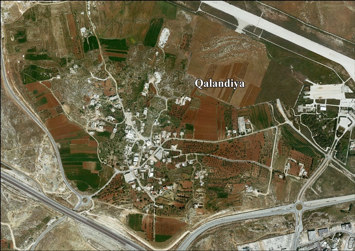
Qalandia or Qalandiya (Template:Langx), also known as Kalandia (Template:Langx), is a Palestinian village located in the West Bank, between Jerusalem and Ramallah, just west of the West Bank barrier. The village had a population of 572 residents in 2017.<ref name="PrelimCensus2017" /> Qalandia is also the name of a refugee camp, established by UNRWA in 1949. It is located just east of Jerusalem municipality. Qalandia refugee camp was built for Palestinian refugees who fled from Lydda, Ramla, and Jerusalem during the 1948 Palestinian expulsion and flight.<ref>Kalandia Refugee Camp</ref>
History
A large Jewish farmhouse from the late Second Temple period has been discovered in Qalandiya.<ref name=":0">Template:Cite book</ref><ref name=":1">Magen, Y. (2004). Qalandiya–A Second Temple-period Viticulture and Wine-manufacturing Agricultural Settlement. The Land of Benjamin, 3.</ref><ref name=":2">Ariel, D. T. (2004). The Coins from Qalandiya. The Land of Benjamin, 3, 145-177.</ref> Occupied from the Hellenistic period until its destruction during the First Jewish–Roman War, the site includes two large structures and rock-cut industrial facilities, including wine and oil presses.<ref name=":1" /><ref name=":2" /> The presence of two miq'vaot and typical stone vessels indicates the site's Jewish identity.<ref name=":0" /> Excavations yielded two complete amphoras, several amphora fragments,<ref name=":0" /> hundreds of coins, potsherds, chalk vessels, metal objects, jewelry, and various tools. Nearby exploration revealed burial caves, winepresses, cisterns, and quarries.<ref name=":1" /><ref name=":2" />
Ancient tombs have been found at Qalandia.<ref name="SWP11">Conder and Kitchener, 1883, SWP III, p. 11</ref> A Byzantine bath has been excavated, and pottery from the same period has also been located there.<ref>Dauphin, 1998, p. 844</ref><ref>Baramki, 1933, pp. 105-109</ref>
During the Crusader period, it was noted that Qalandia was one of 21 villages given by King Godfrey as a fief to the canons of the Holy Sepulchre.<ref name=SWP11/><ref>de Roziére, 1849, p. 30: Calandria, p.263: Kalendrie, cited in Röhricht, 1893, RRH, pp. 16-17, No 74</ref><ref>Röhricht, 1904, RHH Ad, p. 5, No. 74</ref><ref>Rey, 1883, p. 387</ref> In 1151 the Abbot leased the use of the vineyards and orchards of Qalandia to a Nemes the Syrian and his brother Anthony and their children. In return the convent was given a part of the yearly production from these fields.<ref>de Roziére, 1849, pp. 159-160, cited in Röhricht, 1893, RRH, p. 67-68, No. 267</ref> In 1152 Queen Melisende exchanged villagers whom she owned for shops and two moneychanger counters in Jerusalem. All the names of the Qalandia villagers were Christian, which indicate that Qalandia was a Christian village at the time.<ref>Röhricht, 1893, RHH, pp. 70-71, No 278</ref><ref>Ellenblum, 2003, pp. 235 -236</ref>
Ottoman era
Qalandia, like the rest of Palestine, was incorporated into the Ottoman Empire in 1517. In the Ottoman census of 1596, the village, called Qalandiya, was a part of the nahiya ("subdistrict") of Al-Quds which was under the administration of the liwa ("district") of Al-Quds. The village had a population of 15 households, all Muslim, and paid a fixed tax rate of 33.3% on wheat, barley, olives, beehives and/or goats, in addition to occasional revenues; a total of 3,900 akçe.<ref>Hütteroth and Abdulfattah, 1977, p. 116</ref>
In 1838, it was noted as a Muslim village in the Jerusalem District.<ref>Robinson and Smith, 1841, vol.3, Appendix 2, p. 122</ref><ref>Robinson and Smith, 1841, vol. 2, pp. 137, 141, 315</ref>
In 1863, the French explorer Victor Guérin visited the village, which he described as small hamlet consisting of a few houses with fig plantations around them,<ref>Guérin, 1868, p. 393, Guérin, 1869, p. 6</ref> while an Ottoman village list of about 1870 showed 16 houses and a population of 50, though the population count included only the men.<ref>Socin, 1879, p. 155</ref><ref>Hartmann, 1883, p. 127, also noted 16 houses</ref>
In 1883, the PEF's Survey of Western Palestine described the village as a "small village on a swell, surrounded by olives, with quarries to the west."<ref>Conder and Kitchener, 1883, SWP III, pp. 10-11</ref>
In 1896 the population of Kalandije was estimated to be about 150 persons.<ref>Schick, 1896, p. 121</ref>
British Mandate era
In the 1922 census of Palestine conducted by the British Mandate authorities, Qalandieh (Qalandia) had a population of 144, of which 122 Muslims and 22 Jews.<ref name=Census1922>Barron, 1923, Table VII, Sub-district of Jerusalem, p. 15</ref> This had decreased in the 1931 census when Qalandiya had an all-Muslim population of 120, in 25 houses.<ref name="Census1931">Mills, 1932, p. 42</ref>
In the 1945 survey, Qalandia had a population of 190 Muslims,<ref name=1945p25>Department of Statistics, 1945, p. 25</ref> and a land area of 3,940 dunams.<ref name=Hadawi58>Government of Palestine, Department of Statistics. Village Statistics, April, 1945. Quoted in Hadawi, 1970, p. 58</ref> 427 dunams were designated for plantations and irrigable land, 2,202 for cereals,<ref>Government of Palestine, Department of Statistics. Village Statistics, April, 1945. Quoted in Hadawi, 1970, p. 103</ref> while six dunams were built-up.<ref>Government of Palestine, Department of Statistics. Village Statistics, April, 1945. Quoted in Hadawi, 1970, p. 153</ref>
Qalandia airport
{{#invoke:Labelled list hatnote|labelledList|Main article|Main articles|Main page|Main pages}} An airstrip to the east of Qalandia was built by the British army in 1925. It was located a few kilometers north of Jerusalem at a site that offered flat terrain in a largely hilly region. In 1936 it was renovated by the Jewish entrepreneur Pinchas Rutenberg and began to be used commercially on a limited basis by Rutenberg’s airline, Palestine Airways, and the British carrier, Imperial Airways.<ref>Palestine Studies, Gateway to the World-The Golden Age of Jerusalem Airport, 1948–67</ref>
Until 1927, it was the only airport in Mandatory Palestine, although there were several military airfields. Qalandia was used for prominent guests bound for Jerusalem.<ref>An Empire in the Holy Land: Historical Geography of the British Administration of Palestine, 1917-1929 Gideon Biger, St. Martin's Press and Magnes Press, New York & Jerusalem, 1994, p. 152</ref> It opened for regular flights in 1936.<ref>Atarot and the Fate of the Jerusalem Airport</ref>

After the Six-Day War, it was renamed Atarot Airport by Israel, but closed down due to disturbances related to the Israeli–Palestinian conflict, and because international companies refused to land there.<ref>Template:Cite news</ref> Israel confiscated 639 dunums from Qalandia village in order to establish a military base at the former airport.<ref name=ARIJ16/>
1947–1949
During the 1947–1948 Civil War in Mandatory Palestine, in early January 1948, the residents of Qalandia evacuated the village and moved to Ramallah, leaving a few young men to protect the property and make sure mines were not planted on the way leading to the village and the nearby mine.<ref>Gelber, 2004, p.139</ref> The villagers returned to the village, and after the news of the Deir Yassin massacre arrived, the women, the children, and most of the men were evacuated again and the village became a post of the Arab Liberation Army<ref>Gelber, 2004, p.162</ref> In the wake of the 1948 Arab–Israeli War, and after the 1949 Armistice Agreements, Qalandia came under Jordanian rule. It was annexed by Jordan in 1950.
Qalandia refugee camp
{{#invoke:Labelled list hatnote|labelledList|Main article|Main articles|Main page|Main pages}} The Qalandia refugee camp was established in 1949 by the Red Cross<ref>Gelber, 2004, p.363</ref> on land leased from Jordan. It covers Template:Convert as of 2006,<ref name=ochaoptPDF>Qalandia Refugee Camp Profile Template:Webarchive</ref> and has a population of 10,024,<ref>Kalandia Refugee Camp</ref> with 935 structures divided into 8 blocks.<ref name=ochaoptPDF/> Israeli authorities consider it part of Greater Jerusalem, and it remains under their control.<ref name="unrwa">United Nations Relief and Works Agency for Palestine Refugees in the Near East (date unknown). Where We Work - West Bank - Camp Profiles - Kalandia. "The Israeli authorities consider this area as part of Greater Jerusalem, and the camp was thus excluded from the redeployment phase in 1995. Qalandia camp remains under Israeli control today." Retrieved from http://www.unrwa.org/where-we-work/west-bank/camp-profiles?field=12&qt-view__camps__camp_profiles_block=3.</ref>
1967–present
Since the Six-Day War in 1967, Qalandia has been under Israeli occupation.
After the 1995 accords, 2% of Qalandiya’s land was classified as Area B, while the remaining 98% is Area C.<ref name=ARIJ16>Qalandiya Village Profile, p. 16, ARIJ</ref> Israel has confiscated 574 dunams of land from Qalandiya in order to construct the Israeli industrial settlement Atarot, and 639 dunams for the Israeli Qalandiya military base.<ref name=ARIJ16/> 1,940 dunums of the village–59.3% of the village’s total area–is isolated behind the Israeli West Bank barrier.<ref name=ARIJ17>Qalandiya Village Profile, p. 17, ARIJ</ref> In 2006, 1,154 people were living in the village according to the Palestinian Central Bureau of Statistics.<ref>Projected Mid -Year Population for Jerusalem Governorate by Locality 2004- 2006 Template:Webarchive Palestinian Central Bureau of Statistics.</ref>
The Qalandia checkpoint is the main checkpoint between the northern West Bank and Jerusalem, and is known for frequent demonstrations against the occupation.<ref>{{#invoke:citation/CS1|citation |CitationClass=web }}</ref>
The Israeli 2013 Qalandia raid led to clashes with local residents, leaving three of Qalandia's inhabitants dead and several critically wounded.<ref>Funerals held for three Palestinians shot dead by Israeli troops, The Guardian, Monday 26 August 2013</ref>
References
Bibliography
- Template:Cite journal
- Template:Cite book
- Template:Cite book
- Template:Cite book
- Template:Cite book
- Template:Cite book
- Template:Cite book
- Template:Cite book
- Template:Cite book
- Template:Cite book
- Template:Cite journal
- Template:Cite book
- Template:Cite book
- Template:Cite book
- Template:Cite book
- Template:Cite book
- Template:Cite book
- Template:Cite book
- Template:Cite book
- Template:Cite book
- Template:Cite journal
- Template:Cite journal
External links
- Welcome to Qalandiya – via Palestine Remembered
- Qalandia – via Welcome to Palestine
- Survey of Western Palestine, Map 17: IAA, Wikimedia commons
- Qalandiya Village (fact sheet) – Applied Research Institute–Jerusalem, (ARIJ)
- Qalandiya Village profile – ARIJ
- Qalandiya aerial photo – ARIJ
- Locality Development Priorities and Needs in Qalandiya – ARIJ
- Kalandia Refugee Camp – articles from UNRWA
- Kalandia Checkpoint acts as door to Jerusalem
Template:Jerusalem Governorate Template:Palestinian refugee camps Template:Authority control