File:Zamboanga province map 1918.JPG
Jump to navigation
Jump to search
Size of this preview: 361 × 599 pixels. Other resolutions: 145 × 240 pixels | 617 × 1,023 pixels.
Original file (617 × 1,023 pixels, file size: 257 KB, MIME type: image/jpeg)
Summary
| Description |
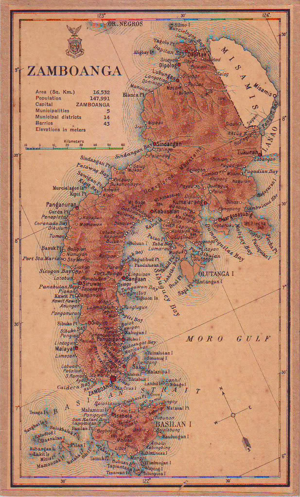
English: Map of Zamboanga province in 1918 |
| Date | |
| Source | Census of the Philippine Islands (1918) |
| Author | Census Office of the Philippine Islands |
Licensing
This media file is in the public domain in the United States. This applies to U.S. works where the copyright has expired, often because its first publication occurred prior to January 1, 1930, and if not then due to lack of notice or renewal. See this page for further explanation.
|
 | |
 |
File history
Click on a date/time to view the file as it appeared at that time.
| Date/Time | Thumbnail | Dimensions | User | Comment | |
|---|---|---|---|---|---|
| current | 04:13, 3 August 2015 | | 617 × 1,023 (257 KB) | wikimediacommons>Namayan | User created page with UploadWizard |
File usage
The following 3 pages use this file: