Lake Jackson Mounds Archaeological State Park
Template:Short description Template:Use mdy dates Template:Infobox protected area
Lake Jackson Mounds Archaeological State Park (8LE1) is one of the most important archaeological sites in Florida, the capital of chiefdom and ceremonial center of the Fort Walton Culture inhabited from 1050–1500. The complex originally included seven earthwork mounds, a public plaza and numerous individual village residences.
One of several major mound sites in the Florida Panhandle, the park is located in northern Tallahassee, on the south shore of Lake Jackson. The complex has been managed as a Florida State Park since 1966. On May 6, 1971, the site was listed on the U.S. National Register of Historic Places as reference number 71000241.<ref>{{#invoke:citation/CS1|citation |CitationClass=web }}</ref>
Fort Walton culture
The site was built and occupied between 1000 and 1500 by people of the Fort Walton culture, the southernmost expression of the Mississippian culture. The scale of the site and the number and size of the mounds indicate that this was the site of a regional chiefdom, and was thus a political and religious center.<ref name=PAYNE1994>Template:Cite thesis</ref> After the abandonment of the Lake Jackson site the chiefdom seat was moved to Anhaica (rediscovered in 1987 by B. Calvin Jones and located within DeSoto Site Historic State Park), where in 1539 it was visited by the Hernando de Soto entrada, who knew the residents as the historic Muskogean-speaking Apalachee people.<ref name=HUDSON1997>Template:Cite book</ref> Other related Fort Walton sites are located at Velda Mound (also a park), Cayson Mound and Village Site and Yon Mound and Village Site.
Site description
When the site was abandoned it was a large complex (Template:Convert<ref name=PAYNE1994/>) that included seven platform mounds, six arranged near a plaza and a seventh (Mound 1) located Template:Convert to the north.<ref name=BIGMAN2015>Template:Cite journal</ref> The mounds were the result of skilled planning, knowledge of soils and organization of numerous laborers over the period of many years. The ceremonial plaza was a large flat area, constructed and leveled for this purpose, where ritual games and gatherings took place. The area around the mounds and plaza had several areas of heavy village habitation with individual residences, where artisans and workers lived. There were also communal agricultural fields in the surrounding countryside, where the people cultivated maize in the rich local soil, the major reason such a dense population and large site were possible.<ref name=BROWN1994>Template:Cite book</ref> Only a few of the mounds in the park have been systematically excavated by archaeologists.
The site itself is oriented on an east–west axis, oriented perpendicular to the north–south axis of the Meginnis Arm, a nearby extension of Lake Jackson. All of the mounds are laid out to reflect this alignment, although it is unclear if this is symbolic or merely the result of the lake arm's orientation.<ref name=PAYNE1994/>
Phases

During the Lake Jackson I phase the site consisted of small village possibly with the beginnings of Mound 2 started. During the Early Lake Jackson II phase the population and the habitation areas of the site expanded greatly. Many of the areas that would later become mounds were village areas at this time, including the locations of Mounds 3 and 4, as well as areas north of Mounds 2 and 4. Mound 5 was begun and Mound 2 was started during this time. Mounds 3, 4, and 6 were probably not yet started. No evidence exists for occupation in the vicinity of Mound 6. A small area around Mound 5 continued to be occupied during early Lake Jackson II. The areas north of Mound 4 and between Mounds 2 and 4 show evidence of dense occupation during this time. During the Late Lake Jackson II phase, all 7 mounds had been started and most had seen numerous construction episodes. Mound 5 and Mound 6 were possibly finished, and Mounds 2, 3, and 4 were under way but had not had their final stages reached yet. The area to the south and west of Mound 4 and the area between Mounds 2 and 4 continues to be occupied. There is dense occupation north of Mound 2. In the Lake Jackson III phase, the central part of the site is occupied more intensively especially around Mound 2 and spreading north. Mounds 4, 5, and 6 are completed before the beginning of the phase, and Mounds 2 and 3 are finished during the phase. After this point at about 1500, the site is virtually abandoned. There is occasional evidence that the site is still visited in the succeeding Velda phase (1500-1633), but very few artifacts or evidence of habitation from this time period have been found.<ref name=PAYNE1994/>
Ceramic chronology
{{#invoke:Labelled list hatnote|labelledList|Main article|Main articles|Main page|Main pages}} Archaeologists use changes in ceramic styles to determine timelines for sites and entire regions. The ceramics found at Lake Jackson have been reconstructed into the following sequences using these ceramic markers.
| Site phase | Dates | Ceramic markers |
|---|---|---|
| Fort Jackson I | 1050 - 1150 | Fort Jackson incised, Wakulla Check Stamped, mica inclusions in clay paste, unaltered rims, few of the typical Mississippian vessel forms, motifs, or
appendages |
| Early Fort Jackson II | 1150 - 1250 | Wakulla Check Stamped, Carrabelle Punctated var MeGinnis, Fort Jackson incised, Cool Branch incised, Marsh Island incised, Lake Jackson incised, cob marked pottery, red filmed pottery, unaltered or folded rims, loop and strap handles, occasional mica inclusions, collared jars, other kinds of jars, carinated bowls, bottles, and beakers |
| Late Fort Jackson II | 1250 - 1400 | Fort Jackson incised, Cool Branch incised, Marsh Island incised, Lake Jackson incised, red filmed pottery, altered rims(notched, ticked or scalloped), loop and strap handles continue, with strap handles being more frequent than before, lugs make first appearance, occasional mica inclusions, |
| Fort Jackson III | 1400 -1500 | Fort Jackson incised continues but without var Cayson and Englewood, no mica inclusions, carinated bowls, Fort Walton Incised, Marsh Island Incised or strap handles, Lake Jackson incised, red filmed pottery, altered rims(notched, ticked, scalloped and fluted) all continue with fluted becoming charasteristic |
<ref name=PAYNE1994/>
Mound 2

In the center of the complex is Mound 2, the largest and the best-preserved mound at the site, it measures 36 ft high and 272 ft by 312 ft at the base (11 m × 83 m × 95 m). Like all of the mounds at the site where an original shape can be determined, it is a simple truncated-pyramidal platform mound. Very little excavation has taken place at this mound, so not much is known about the construction sequence or what structures may have been built upon it. There was limited work done on the mound in 1947 by John Griffin, in a salvage cleanup effort of a looters trench. He found a series of fill layers of black muck, various soil types, and caps of red clay, but as the cut was not through the entire mound or located near any structures he could not learn much about its construction sequence or definitive purpose. It was most likely the first mound started at the site, early in Fort Jackson's history. If it is similar to mounds at other sites, then it was the house platform of the ruler of the site, who was also possibly a paramount chief over many other sites.<ref name=PAYNE1994/>
Mound 3

Located Template:Convert across a plaza to the south of Mound 2 is Mound 3, the third-largest and third-tallest mound at the site. Mound 3 was used as a mortuary mound by its builders.<ref name=PAYNE1994/> At the end of its construction, it was 5 m in height and 44 by 48 m at the base (16 ft × 144 ft × 157 ft).<ref name="LEDOUX2009">Template:Cite thesis</ref>Template:Better source needed Based on radiocarbon dating done during excavations, the mound is known to have been constructed between 760 years and 475 years Before Present (based on 1950 as present), or approximately between 1190 and 1475.<ref name=BROWN1994/> Below ground level of Mound 3, was a village midden showing residential occupation at this spot before the construction of the mound began. The first activity other than village occupation is a leveling of the location and pit dug and filled with 35 stone projectile points and burned organic material. This is covered over with a layer of clay and structure erected. This building may have been used for feasting rituals. After a period of time this structure was then burned and the first Template:Convert of mound layer was erected over it. The first burial is included in this layer.<ref name=LEDOUX2009/>Template:Better source needed The mound was built up in intervals, with new levels being added in stages. The bulk of the mound fill was a mixture of scraped up midden materials.<ref name=PAYNE1994/> White sand from the lake shore was used as a first layer in each new episode, followed by mound fill and then a red clay from nearby hills was put on in a thin layer as a final cap. The pattern of deposits of fill demonstrated that the earth was intentionally brought to the site, in baskets as individual basket loads could be detected during excavations.<ref name=BROWN1994/>
Postholes found on the mound summit indicated that buildings with encircling palisades were erected on the flat top. The last structure erected on the summit measured Template:Convert and was aligned in a north–south axis just like the mound itself. This rectangular structure is unusual for Apalachee architecture, as most of their structures were round in shape. Archaeologists theorize this may be because of outside influences from other Mississippian centers where rectangular structures are common.<ref name=PAYNE1994/> The period burning, new fill layer, cap, and structure cycle was repeated twelve times in the 250-year lifespan of the mound. Based on studies at Cahokia (a very large mound center in Illinois)<ref name=BROWN1994/> and other Mississippian culture sites, scholars believe that structures were destroyed and the mounds "renewed" with new higher layers of fill and new colored clay caps.<ref>Template:Cite book</ref><ref name=HANDBOOK>Template:Cite book</ref> The time span in between renewals at many sites suggests the average lifespan of a ruler and their death and replacement by a successor.<ref>Template:Cite thesis</ref>
The mounds location on private property outside the state owned park meant it was not protected as the mounds inside the park are and it was leveled for use as fill dirt in the winter of 1975–1976. Before it was dug away B. Calvin Jones, an archaeologist with the State of Florida Bureau of Historic Sites and Properties, conducted a salvage operation.<ref name=BROWN1994/> He recovered 24 burials from Mound 3, with others known to have been lost in the destruction of the mound. Seven of the twelve levels that had been the top of the mound had graves dug into them. Graves dug into the other levels may have been lost as the mound was destroyed. The burials were in deep pits, some lined with split logs, but each grave was kept track of as none were dug down into previous graves. Before burial the bodies were wrapped in cloth and an embossed copper plate placed on their chest. They were then wrapped in leather and cane matting and placed into the prepared pit graves and split logs placed over them. This entire procedure of wrapping the body is reminiscent of "bundling", a practice used for sacred objects which has a long history among Native North Americans.<ref name=LEDOUX2009/>Template:Better source needed A selection of other grave goods have been found wrapped in the bundles. In the sequence from lower to higher levels (oldest to more recent), the grave goods became more elaborate. In the upper levels, the grave goods included many objects made of copper, beads made of shell and pearl, and pipes associated with ritual use of tobacco. Although most of the burials were of elite men, the graves included one woman (buried with the most elaborate falcon dancer copper plate<ref name=POWER2004/>) and a child of about eleven years of age, probably of the elite class. One of the bodies had been cremated. The bones of a dog were found on top of one of the clay levels that was an earlier top surface of the mound.<ref name=BROWN1994/>
Mounds 1, 4, 5, 6, and 7
Mound 1 was partially excavated in the mid to late 1950s by Charles H. Fairbanks and Hale G. Smith for the Department of Anthropology at Florida State University. All information from the excavation except for a single photo and a partial list of artifacts found are currently missing and presumed lost.<ref name=PAYNE1994/> Mound 1 is the only mound not currently located within the boundaries of the park and remains privately owned.<ref name=MARRINAN2007>Template:Cite journal</ref>
Mound 4 was built between 1250 and 1400. It was started when a layer of white sand was laid down over a previous habitation area and covered with Template:Convert of basket-loaded mound fill and covered with a red-clay cap. It had several more similar construction phases. A series of postholes were discovered at the summit by John Griffin in 1947, but due to time constraints with the work season he could not proceed any further.<ref name=PAYNE1994/>
Mound 5, the smallest mound at the site, went through at least two phases of mound construction. It was built over a former village area but did not receive a coat of white sand before mound construction as did Mound 4. It seems to have been abandoned sometime during the Late Lake Jackson phase.<ref name=PAYNE1994/>
Mound 6 was also built on top of an earlier habitation area, and was also given a layer of light-colored sand before the mound was started. Several layers were added over the years and evidence for habitations structures was found on the successive summits. Artifacts found in the mound date to 1250 to 1400, during the Late Lake Jackson II phase.<ref name=PAYNE1994/>
Mound 7 has never been excavated and has almost nothing known about it. Its seriously degraded shape does not even permit its identification as a platform mound with certainty.<ref name=PAYNE1994/>
-
 Mound 1
 -
 Mound 2
 -
 Mound 2
 -
 Mound 4


Plazas
The layout and arrangement of the mounds in the central area of the site suggests that there may have been two large plaza areas. Mounds 2, 3, 4, and 5 form a large rectangular shape that was mostly free of debris. Mounds 2, 3, 6, and 7 also form a rectangular shape that suggests it too was a plaza. Both plazas would have had Butler's Mill Creek (a small stream that once bisected these areas, but whose course was altered in historic times) running through it. Excavations have shown that a clean area between Mounds 2 and 4 was a plaza, but not enough work has been done at the rest of the site to confirm the larger dimension suggested by the first arrangement or the existence of a plaza at the second arrangement at all.<ref name=PAYNE1994/>
Connection to the S.E.C.C.


{{#invoke:Labelled list hatnote|labelledList|Main article|Main articles|Main page|Main pages}} Artifacts found at the Lake Jackson site include plain and repoussé copper plates, copper headdress badges, engraved shell gorgets,<ref name=JONES1982>Template:Cite journal</ref> pearl beads, copper axes, and stone and ceramic pipes.<ref name=POWER2004>Template:Cite book</ref> Many of these pieces had motifs representative of the Southeastern Ceremonial Complex or SECC. Similar artifacts have been found at the Spiro site in Oklahoma, the Moundville site in Alabama and Etowah Mounds in northwestern Georgia. Stylistic analysis has shown that of the three, Lake Jackson had the closest ties with Etowah.<ref name=JONES1982/> The burials found in Mound 3 were ranked into 3 levels: the elite who were buried with the most-elaborate copper items, pearl beads and shark-teeth-adorned clothing, the middle rank who were interred with stone axes or shell/bead necklaces, and the low-ranked who did not have any high-status grave goods. The iconography of the items also slowly changes with time, growing more complex and numerous and thought by archaeologists to be evidence of influences from other elite polities and the development of a full-fledged local warrior class. At least ten of the burials unearthed at the mound were of "elite war leaders".<ref name=POWER2004/> The most elaborate embossed copper plate found in Mound C greatly resembles the two Rogan plates found in Mound C at the Etowah Site. The three plates are in the Classic Braden style associated with Cahokia, and it is generally thought that the plates were manufactured there before ending up at sites in the Southeast.<ref>Template:Citation</ref>Template:Better source needed The Lake Jackson plate depicts a winged dancing figure holding a ceremonial mace in one hand and a severed head in the other. The figure wears an elaborate headdress with an ogee symbol and a bi-lobed arrow motif. Actual copper ogee plates used as headdress were found in burials at Etowah. These motifs are also found on sculptures and shell engravings from the Spiro site, such as the ogee headdress-wearing "Resting Warrior or Big Boy statue".<ref name=POWER2004/> The ogee is usually associated with underworld figures. The figure also appears to be wearing a long-nosed god maskette (an object thought to be associated with ritual adoption<ref name=AZTALAN>{{#invoke:citation/CS1|citation |CitationClass=web }}</ref> and also worn as ear-rings by the Resting Warrior<ref name=TEJASMISSWORLD>{{#invoke:citation/CS1|citation |CitationClass=web }}</ref>) and clothing which are all motifs associated with the falcon dancer/warrior/chunkey player including the columnella pendant, large shell beads, bellows apron (scalp motif), and the long-waist sash.<ref name=POWER2004/> This plate was one of 14 recovered from the mound, along with 11 copper axes, many copper headdress ornaments, a few polished-stone celts, marine-shell drinking cups of the type historically used for the black drink ritual, and pottery vessels and a few non-local materials such as mica, graphite pigment, red ocher and stone discoidals. All of the copper pieces came to Lake Jackson by way of the Etowah site which shows that the two sites had a long-running relationship, trading their specific local prestige products to each other. The Etowahans prized the whelk shells from the Gulf Coast for the making of shell gorgets and ritual drinking cups and the Lake Jackson elites valued the prestigious Etowah plates and other copper objects. This monopoly on the shell trade by the Etowahans lasted until the fall of the chiefdom in about 1375, after which the elite status goods used in burials in Mound 3 come from other locations, mostly the northern Georgia and eastern Tennessee area.<ref name=LEDOUX2009/>Template:Better source needed
State Park
In May 1966, a T-shaped tract containing Template:Convert was purchased by the State of Florida and designated the Lake Jackson Mounds State Archaeological Site, to be administered by the then Florida Department of Natural Resources. At the time of this purchase, three-quarters of Mound 2 was in the park, all of Mound 4 was included in the park, and about half of Mound 5, with the remaining other mounds still privately owned.<ref name=PAYNE1994/> Later more tracts were purchased and as of 2007, only Mound 1 remained outside the boundary of the park.<ref name=MARRINAN2007/> The large park has areas for such activities as trails for hiking and wooden tables for picnicking.<ref>{{#invoke:citation/CS1|citation |CitationClass=web }}</ref>
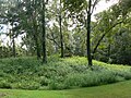
The Lake Jackson Mounds Archaeological State Park is recognized as part of the Native American Heritage Trail under the Florida Division of Historical Resources. There are also two trails available for hiking throughout the park. The first one is a 0.75 mile interpretive trail that gives a brief glimpse into the Florida Territorial Period (1820-1860). The land was owned by Colonel Robert Butler as part of a larger estate. The second trail is 2.2 miles and consists of a nature trail that meanders through the natural growth of native plants and trees. Visitors on this trail may be able to see a grist mill from the 1800s while hiking.<ref name=STATEPARK>{{#invoke:citation/CS1|citation |CitationClass=web }}</ref> The Florida State Parks website for Lake Jackson Mounds Archaeological State Park provides a great deal of information, including a downloadable map of the park. The park encompasses six out of seven of the known mounds, with two of the largest mounds visible to visitors who use the picnic tables. There is an interpretive exhibit aspect of the park that shares knowledge about the Native Americans who once occupied the site. This is located in the pavilion with the picnic tables.
Archaeological excavations have been ongoing at the park for many years. Any artifacts recovered during these excavations are property of the Florida Division of Historic Resources. They are housed in a storage facility that meets the requirements for curating artifacts under the 36 CFR Part 79 under the Code of Federal Regulations for Section 106 compliance.<ref>{{#invoke:citation/CS1|citation |CitationClass=web }}</ref> Artifacts recovered from various excavations at the park include pottery sherds, shells, flint and other stone tool fragments, burial objects made of copper, mica, and other materials. Vegetative artifacts were also located.<ref>{{#invoke:citation/CS1|citation |CitationClass=web }}</ref>
Admission to the park is low, costing $3 per vehicle and is collected using the honor system. Pedestrians and visitors on bikes are charged only $2.<ref>{{#invoke:citation/CS1|citation |CitationClass=web }}</ref> The park is open for visiting from 8:00am until sunset every day. There are many different activities available at the park, including birding, hiking, picnicking, and wildlife viewing. Guided tours are available and must be booked two weeks in advance for groups up to 50 visitors. There is parking available and restroom facilities onsite. Pets are allowed as long as they are kept on the leash.<ref name=STATEPARK />
Endangered species
The park is home to an endangered species of plant, the Trillium reliquum. It was discovered by hikers in February 2010. This species was previously thought to inhabit only parts of Alabama, Georgia and South Carolina. The U.S. Fish and Wildlife Service is working to catalog the population.Template:Citation needed
See also
Citations
References
External links
- Lake Jackson Mounds Archaeological State Park at Florida State Parks
- Leon County listings at National Register of Historic Places
- Leon County listings at Florida's Office of Cultural and Historical Programs
- Lake Jackson Mounds State Archaeological Site at Absolutely Florida
- Template:Cite thesis
Template:Mississippian and related cultures Template:Indigenous peoples of Pre-Columbian Florida Template:Pre-Columbian North America Template:Protected areas of Florida Template:National Register of Historic Places
- State parks of Florida
- Parks in Tallahassee, Florida
- National Register of Historic Places in Tallahassee, Florida
- Protected areas established in 1971
- Fort Walton culture
- Archaeological sites in Florida
- Archaeological parks
- Florida Native American Heritage Trail
- Mounds in Florida
- Archaeological sites on the National Register of Historic Places in Florida
- Former populated places in Leon County, Florida
- 1971 establishments in Florida