Dyker Heights, Brooklyn
Template:Short description Template:Use mdy dates Template:Use American English Template:Main other{{#invoke:Infobox|infobox}}Template:Template other{{#invoke:Check for unknown parameters|check|unknown=Template:Main other|preview = Page using [[Template:Template:If empty]] with unknown parameter "_VALUE_"|ignoreblank=y|mapframe_args=y | alt | anthem | anthem_link | area_blank1_acre | area_blank1_dunam | area_blank1_ha | area_blank1_km2 | area_blank1_sq_mi | area_blank1_title | area_blank2_acre | area_blank2_dunam | area_blank2_ha | area_blank2_km2 | area_blank2_sq_mi | area_blank2_title | area_code | area_code_type | area_codes | area_footnotes | area_land_acre | area_land_dunam | area_land_ha | area_land_km2 | area_land_sq_mi | area_metro_acre | area_metro_dunam | area_metro_footnotes | area_metro_ha | area_metro_km2 | area_metro_sq_mi | area_note | area_rank | area_rural_acre | area_rural_dunam | area_rural_footnotes | area_rural_ha | area_rural_km2 | area_rural_sq_mi | area_total_acre | area_total_dunam | area_total_ha | area_total_km2 | area_total_sq_mi | area_urban_acre | area_urban_dunam | area_urban_footnotes | area_urban_ha | area_urban_km2 | area_urban_sq_mi | area_water_acre | area_water_dunam | area_water_ha | area_water_km2 | area_water_percent | area_water_sq_mi | blank_emblem_alt | blank_emblem_link | blank_emblem_size | blank_emblem_type | blank_emblem_sizedefault | blank_emblem_upright | blank_info | blank_info_sec1 | blank_info_sec2 | blank_name | blank_name_sec1 | blank_name_sec2 | blank1_info | blank1_info_sec1 | blank1_info_sec2 | blank1_name | blank1_name_sec1 | blank1_name_sec2 | blank2_info | blank2_info_sec1 | blank2_info_sec2 | blank2_name | blank2_name_sec1 | blank2_name_sec2 | blank3_info | blank3_info_sec1 | blank3_info_sec2 | blank3_name | blank3_name_sec1 | blank3_name_sec2 | blank4_info | blank4_info_sec1 | blank4_info_sec2 | blank4_name | blank4_name_sec1 | blank4_name_sec2 | blank5_info | blank5_info_sec1 | blank5_info_sec2 | blank5_name | blank5_name_sec1 | blank5_name_sec2 | blank6_info | blank6_info_sec1 | blank6_info_sec2 | blank6_name | blank6_name_sec1 | blank6_name_sec2 | blank7_info | blank7_info_sec1 | blank7_info_sec2 | blank7_name | blank7_name_sec1 | blank7_name_sec2 | caption | code1_info | code1_name | code2_info | code2_name | coor_pinpoint | coor_type | coordinates | coordinates_footnotes | demographics_type1 | demographics_type2 | demographics1_footnotes | demographics1_info1 | demographics1_info10 | demographics1_info2 | demographics1_info3 | demographics1_info4 | demographics1_info5 | demographics1_info6 | demographics1_info7 | demographics1_info8 | demographics1_info9 | demographics1_title1 | demographics1_title10 | demographics1_title2 | demographics1_title3 | demographics1_title4 | demographics1_title5 | demographics1_title6 | demographics1_title7 | demographics1_title8 | demographics1_title9 | demographics2_footnotes | demographics2_info1 | demographics2_info10 | demographics2_info2 | demographics2_info3 | demographics2_info4 | demographics2_info5 | demographics2_info6 | demographics2_info7 | demographics2_info8 | demographics2_info9 | demographics2_title1 | demographics2_title10 | demographics2_title2 | demographics2_title3 | demographics2_title4 | demographics2_title5 | demographics2_title6 | demographics2_title7 | demographics2_title8 | demographics2_title9 | dimensions_footnotes | dunam_link | elevation_footnotes | elevation_ft | elevation_link | elevation_m | elevation_max_footnotes | elevation_max_ft | elevation_max_m | elevation_max_point | elevation_max_rank | elevation_min_footnotes | elevation_min_ft | elevation_min_m | elevation_min_point | elevation_min_rank | elevation_point | embed | established_date | established_date1 | established_date2 | established_date3 | established_date4 | established_date5 | established_date6 | established_date7 | established_title | established_title1 | established_title2 | established_title3 | established_title4 | established_title5 | established_title6 | established_title7 | etymology | extinct_date | extinct_title | flag_alt | flag_border | flag_link | flag_size | footnotes | founder | geocode | governing_body | government_footnotes | government_type | government_blank1_title | government_blank1 | government_blank2_title | government_blank2 | government_blank2_title | government_blank3 | government_blank3_title | government_blank3 | government_blank4_title | government_blank4 | government_blank5_title | government_blank5 | government_blank6_title | government_blank6 | grid_name | grid_position | image_alt | image_blank_emblem | image_caption | image_flag | image_map | image_map1 | image_seal | image_shield | image_size | image_skyline | imagesize | image_sizedefault | image_upright | iso_code | leader_name | leader_name1 | leader_name2 | leader_name3 | leader_name4 | leader_name5 | leader_party | leader_title | leader_title1 | leader_title2 | leader_title3 | leader_title4 | leader_title5 | length_km | length_mi | map_alt | map_alt1 | map_caption | map_caption1 | mapsize | mapsize1 | module | motto | motto_link | mottoes | name | named_for | native_name | native_name_lang | nickname | nickname_link | nicknames | official_name | other_name | p1 | p10 | p11 | p12 | p13 | p14 | p15 | p16 | p17 | p18 | p19 | p2 | p20 | p21 | p22 | p23 | p24 | p25 | p26 | p27 | p28 | p29 | p3 | p30 | p31 | p32 | p33 | p34 | p35 | p36 | p37 | p38 | p39 | p4 | p40 | p41 | p42 | p43 | p44 | p45 | p46 | p47 | p48 | p49 | p5 | p50 | p6 | p7 | p8 | p9 | parts | parts_style | parts_type | pop_est_as_of | pop_est_footnotes | population | population_as_of | population_blank1 | population_blank1_footnotes | population_blank1_title | population_blank2 | population_blank2_footnotes | population_blank2_title | population_demonym | population_demonyms | population_density_blank1_km2 | population_density_blank1_sq_mi | population_density_blank2_km2 | population_density_blank2_sq_mi | population_density_km2 | population_density_metro_km2 | population_density_metro_sq_mi | population_density_rank | population_density_rural_km2 | population_density_rural_sq_mi | population_density_sq_mi | population_density_urban_km2 | population_density_urban_sq_mi | population_est | population_footnotes | population_metro | population_metro_footnotes | population_note | population_rank | population_rural | population_rural_footnotes | population_total | population_urban | population_urban_footnotes | postal_code | postal_code_type | postal2_code | postal2_code_type | pushpin_image | pushpin_label | pushpin_label_position | pushpin_map | pushpin_map_alt | pushpin_map_caption | pushpin_map_caption_notsmall | pushpin_map_narrow | pushpin_mapsize | pushpin_outside | pushpin_overlay | pushpin_relief | registration_plate | registration_plate_type | seal_alt | seal_link | seal_size | seal_type | seat | seat_type | seat1 | seat1_type | seat2 | seat2_type | settlement_type | shield_alt | shield_link | shield_size | short_description | subdivision_name | subdivision_name1 | subdivision_name2 | subdivision_name3 | subdivision_name4 | subdivision_name5 | subdivision_name6 | subdivision_type | subdivision_type1 | subdivision_type2 | subdivision_type3 | subdivision_type4 | subdivision_type5 | subdivision_type6 | template_name | timezone | timezone_DST | timezone_link | timezone1 | timezone1_DST | timezone1_location | timezone2 | timezone2_DST | timezone2_location | timezone3 | timezone3_DST | timezone3_location | timezone4 | timezone4_DST | timezone4_location | timezone5 | timezone5_DST | timezone5_location | total_type | translit_lang1 | translit_lang1_info | translit_lang1_info1 | translit_lang1_info2 | translit_lang1_info3 | translit_lang1_info4 | translit_lang1_info5 | translit_lang1_info6 | translit_lang1_type | translit_lang1_type1 | translit_lang1_type2 | translit_lang1_type3 | translit_lang1_type4 | translit_lang1_type5 | translit_lang1_type6 | translit_lang2 | translit_lang2_info | translit_lang2_info1 | translit_lang2_info2 | translit_lang2_info3 | translit_lang2_info4 | translit_lang2_info5 | translit_lang2_info6 | translit_lang2_type | translit_lang2_type1 | translit_lang2_type2 | translit_lang2_type3 | translit_lang2_type4 | translit_lang2_type5 | translit_lang2_type6 | type | unit_pref | utc_offset | utc_offset_DST | utc_offset1 | utc_offset1_DST | utc_offset2 | utc_offset2_DST | utc_offset3 | utc_offset3_DST | utc_offset4 | utc_offset4_DST | utc_offset5 | utc_offset5_DST | website | width_km | width_mi }}{{#invoke:Check for clobbered parameters|check | template = [[Template:Template:If empty]] | cat = Template:Main other | population; population_total | image_size; imagesize | image_alt; alt | image_caption; caption | settlement_type; type | utc_offset1; utc_offset | timezone1; timezone }}{{#if:
|
}}Template:Main other{{#ifexpr:{{#invoke:ParameterCount|main|mapframe|image_map|image_map1|pushpin_map}} >2 |Template:Main other}}
Dyker Heights is a predominantly residential neighborhood in the southwest corner of the borough of Brooklyn in New York City. It is on a hill between Bay Ridge, Bensonhurst, Borough Park, and Gravesend Bay. The neighborhood is bounded by 7th and 14th Avenues, 65th Street, and the Belt Parkway on the west, east, north, and south, respectively.
Dyker Heights originated as a speculative luxury housing development in October 1895 when Walter Loveridge Johnson developed a portion of woodland into a suburban community. It maintained its status as a wealthy neighborhood through the 20th century. During the height of his development, the boundaries were primarily between Tenth and Thirteenth Avenues and from 79th Street to 86th Street. The finest homes of the development were situated along the top of the Template:Convert hill, at about Eleventh Avenue and 82nd Street.
Dyker Heights has a suburban character with detached and semi-detached one-and two-family homes, many of which have driveways and private yards, which are uncommon in parts of New York City. The neighborhood contains tree-lined streets, and there are very few apartment buildings. Dyker Heights can be divided in roughly three sections. The southernmost section, south of 86th Street and east of 7th Avenue, contains Dyker Beach Park and Golf Course. The central section between Bay Ridge Parkway and 86th Street, and between 14th Avenue and Fort Hamilton Parkway, is more exclusive in character. The northern border of the neighborhood is more closely integrated with surrounding areas. The Dyker Heights Civic Association, founded in 1928, is a civic group that represents the community's interests. The area as a whole is known for its Christmas lighting displays, which are often elaborate.<ref name="NYCPlanning"/>
Dyker Heights is part of Brooklyn Community District 10, and its primary ZIP Code is 11228.<ref name="NYCPlanning"/> It is patrolled by the 68th Precinct of the New York City Police Department.<ref name="NYPD 68th Precinct"/> Politically it is represented by the New York City Council's 43rd District.<ref>Current City Council Districts for Kings County Template:Webarchive, New York City. Accessed May 5, 2017.</ref>
History
Early development

The neighborhood of Dyker Heights lies within the boundaries of the then-Dutch town of New Utrecht settled in 1657. The area that is now known as Dyker Heights was not developed in the 17th or 18th century because the land was too sloped for farming; it remained common woodland until the mid-19th century. The trees of this forest were used by the townsfolk as a source of firewood and construction material. When the agricultural industry of New Utrecht changed from the farming grains to the cultivation of market garden produce, the trees were cleared for tomatoes, cabbages, and potatoes, among other produce.<ref>{{#invoke:citation/CS1|citation |CitationClass=web }}</ref>
The first house built at the top of the hill (what is now 11th Avenue and 82nd Street, at about Template:Convert above sea level) was built in the late 1820s by Brigadier General René Edward De Russy of the US Army. De Russy was a military engineer who built many forts in the US – from the Canada–US border and the eastern seaboard to the Gulf of Mexico and the Pacific coast – including Fort Hamilton in Brooklyn.<ref>"West Point Museum Collections Template:Webarchive"</ref> Since this was the tallest natural point in southwest Brooklyn, he built his homestead here – it afforded a clear view of the harbor and its defenses, especially Fort Hamilton which was complete by November 1831.<ref>{{#invoke:citation/CS1|citation |CitationClass=web }}</ref> De Russy died in 1865 and his wife, Helen, sold the property in 1888 to Jane Elisabeth Loveridge and Frederick Henry Johnson.
Development by the Johnsons

According to the Brooklyn Eagle, Frederick Johnson did "much toward developing the locality in which he resided. He was the author of the original New Utrecht Improvement Bill, and an ardent advocate of the annexation of the Town to this City."<ref>Brooklyn Eagle, "Frederick H. Johnson's Sudden Death." August 15, 1893, p. 1.</ref> The Town of New Utrecht was annexed to the City of Brooklyn on July 1, 1894. On January 1, 1898, the City of Brooklyn was annexed to the City of New York. Involved with real estate, Johnson was probably aware of the real estate pressures on and potential of the real estate in New Utrecht. With this in mind, he most likely purchased the De Russy estate with the intention of building an upscale residential neighborhood similar to Bensonhurst-by-the-Sea, built by James D. Lynch in 1880–1890 in the Bath Beach section of New Utrecht.<ref name="autogenerated5">"Saitta House – Report Part 1 Template:Webarchive", DykerHeightsCivicAssociation.com</ref> At that time, the Real Estate Record claimed Bensonhurst-by-the-Sea was "the most perfectly developed suburb ever laid out around New York."<ref name=autogenerated3>Marc Linder and Lawrence S. Zacharias, Of Cabbages and Kings County: Agriculture and The Formation of Modern Brooklyn (Iowa City: University of Iowa Press, 1999), p. 275.</ref> The restrictions placed upon the property made Bensonhurst-by-the-Sea "a model settlement, where some of the most refined, intelligent and cultured of New York City and Brooklyn's citizens have built their homes."<ref name=autogenerated3 />
Following Johnson's death on August 15, 1893, at the age of 52, his second son, Walter Loveridge Johnson, took over the real estate business and by October 1895 started Dyker Heights on his parents' property. Johnson named his development "Dyker Heights" after the Dyker Meadow and Beach, which his development overlooks. The meadow and beach received their name from either the Van Dykes (an original New Utrecht family) who built the dykes to drain the meadow, or for the dykes that the Van Dykes built.<ref name=autogenerated5 /> Johnson was able to develop this portion of New Utrecht woodland into a residential community by making necessary improvements to it. In 1890, the only roads present were Kings Highway, 86th Street, Denyse's Lane, and a small unnamed road near Tenth Avenue – none of which were paved and only 86th Street was a thoroughfare specifically planned as such. The remaining land was unimproved. Johnson continued Brooklyn's street grid south with macadam pavement, graded the properties, installed gas, water, telephone, and electricity lines, and planted sugar maple trees – seven on the avenues and twenty along the streets. This opened over two hundred more building sites between Tenth and 13th Avenues as well as between 79th and 86th Streets.<ref>Template:Cite news</ref>
In 1895, Johnson, very much aware of the successful Bensonhurst-by-the-Sea, built three homes. His home was on the southwest corner of 11th Avenue and 82nd Street (across the Avenue from the home of his mother), Albert Edward Parfitt's home was on 82nd Street next to Johnson's, and the last, closest to Tenth Avenue, was the home of Arthur S. Tuttle who was Assistant Engineer of The Water Supply of The City Works Department of The City of Brooklyn. Parfitt was the architect of these three homes. Johnson's house burned down before 1900, Parfitt's was demolished by a developer in 1928 and replaced with seven, run-of-the-mill, fully detached, single-family homes, and Tuttle's house was remodeled over 10 years ago and clad in bright-white and sky-blue brick.<ref name=autogenerated5 />
Throughout the infancy of the development, Johnson was able to use the print press to his advantage. He advertised his suburban homes heavily and stated that the high ground, magnificent ocean view, and careful restrictions made Dyker Heights the handsomest suburb in Greater New York. Based on the newspaper accounts, he was right. In 1896 Johnson built and sold thirty homes in Dyker Heights. By January 1897, the Brooklyn Eagle reported on his achievements. "Mr. Johnson has met with great success in the development of Dyker Heights and had probably done more business and made more sales during the past year than all the rest of the surrounding settlements combined."<ref>Brooklyn Eagle, "Buys Brooklyn Realty," January 17, 1897, p. 5.</ref> In April 1898 sales were still very strong. "Dyker Heights still holds its lead among the suburban sections in building operations, over forty houses having been erected there during the past year... and there are fully twenty more houses about to be built."<ref>Brooklyn Eagle, "Real Estate Market," April 5, 1898, p. 14.</ref> One of its many advantages was the location, which according to the Brooklyn Eagle, "is one of the finest in Greater New York, commanding an extensive view of water from Sandy Hook to the New Jersey Palisades, with Staten Island and the shores of New Jersey directly in front."<ref>Brooklyn Eagle, "Dyker Heights Club House," April 24, 1898, p. 10.</ref> Still more praise in February 1899, "Dyker Heights has been one of the most successful and the most rapid in growth of any of the suburban settlements, over one hundred dwellings, costing from $5,000 to $25,000 each, having been erected there within the last two years."<ref>Brooklyn Eagle, "Real Estate Market," February 1, 1899, p. 14.</ref>
Advantages of the development

In September 1899, The Wall Street Journal even reported on the advantages of the development, recommending it to "the busy man of Wall Street" because of "its magnificent transportation facilities... it can be reached via the Thirty-Ninth Street Brooklyn Ferry and Eighty-Sixth Street Nassau Line in 45 minutes."<ref name=autogenerated4>Wall Street Journal, "Dyker Heights and Wall Street," September 22, 1899, p. 5.</ref> In addition, the article claimed that "the 45 minutes' trip between Dyker Heights and Wall Street by water and rail is as invigorating as the Dyker Heights climate is healthy-living. The rare opportunities afforded by Dyker Heights to the wealthy and to those in moderate circumstances are due largely to the energy, enterprise and good taste of its founder, Mr. Walter L. Johnson."<ref name=autogenerated4 /> A month later, The Wall Street Journal published "An Ideal Spot for a Home". From that article, one can clearly see why Dyker Heights was so successful. Its location and luxurious homes were first rate, "[Dyker Heights] is without a rival as to location, situated as it is at an elevation of [110] feet above the sea level, and is directly opposite the new Dyker Meadow Park... which will be the only seaside park in Greater New York."<ref name=autogenerated2>Wall Street Journal, "An Ideal Spot for a Home," October 24, 1899, p. 2.</ref> The article also explained the exclusiveness of the property, which can be seen in "its massive stone piers with heavy wrought-iron lamps and scrolls" that adorn the entrances.<ref name=autogenerated2 /> In December 1899 the Brooklyn Eagle reported that, "work has recently been commenced upon thirty high-class Houses, the demand for which runs a dead heat with the supply."<ref name=autogenerated6>Brooklyn Eagle, "Dyker Heights Development," December 31, 1899, p. 28.</ref>
Johnson set very high standards for the community: the Wall Street Journal explained "the property is carefully restricted against all nuisances and no building can be erected upon a plot of less than Template:Convert in width by Template:Convert in depth, and each building must cost at least $4,000 and stand well back from the street."<ref name=autogenerated2 /> These regulations, which were similar to those of Bensonhurst-by-the-Sea, were active until 1915. However, the most desirable feature of the area was still the "uninterrupted view of the lower bay from The Narrows to Sandy Hook and Atlantic Ocean, [which] is one of the most magnificent in the country, and nowhere else in the consolidated city is there anything to compare it with. From here can be seen a marine panorama hard to beat."<ref name=autogenerated2 /> Dyker Heights was so desirous that important members of society flocked to it. The Brooklyn Eagle reported in December 1899 that this "drain" on the more established social neighborhoods such as Brooklyn Heights and those in Manhattan, "almost threatens to lower the social tone of the neighborhoods where this universal exodus is effecting a gradual change in the character of the population."<ref name=autogenerated6 />
Late 19th and early 20th centuries
Property on 84th Street near 13th Avenue was made available to the International Sunshine Society in 1906 by lawyer, financier, and promoter George E. Crater Jr.<ref>Template:Citation</ref> The society was able to acquire the house for $11,000, roughly half the market value, and opened the Dyker Heights Home for Blind Babies on 1 November 1906. Cynthia W. Alden, Mary C. Seward, and other society officers worked with the New York City Board of Education to establish the first public kindergarten for blind children at the home in 1907.<ref>Template:Citation</ref> The original building is gone, but the work begun in Dyker Heights provided a legacy of significant reforms in the public education of blind children within New York and other regions of the United States.


One of the many focal points of the neighborhood was the Dyker Heights Club, which started in October 1896.<ref name=autogenerated5 /> By spring of 1898 the club had a $30,000 clubhouse designed by Albert Edward Parfitt on an $8,500 lot, measuring 200×200, located on the northeast corner of 13th Avenue and 86th Street. Johnson moved his real estate office into the clubhouse and hired a full-time architect, Constantine Schubert, who was also a Dyker Heights homeowner. This grand, neo-classical building was demolished in 1929 by the Archbishop John Hughes Knights of Columbus Club, when they acquired the property for $60,000.<ref>One hundredth Anniversary Journal of the Archbishop John Hughes Knights of Columbus Club, 2000.</ref>
Early in the history of Dyker Heights, Johnson continually purchased consecutive tracts of land until the boundaries of Dyker Heights stretched from 79th Street in the north, roughly 86th Street in the south, Tenth Avenue to the west, and about Template:Convert east of 13th Avenue to the east. However, the boundaries of the Neighborhood of Dyker Heights are now defined by the Dyker Heights Post Office on the northwest corner of 13th and 84th Streets; along its northeast edge runs Bay Ridge Avenue; 16th Avenue is its southeast boundary; Fort Hamilton makes its southwest border; and Interstate 278 is the northwest limit.<ref>{{#invoke:citation/CS1|citation |CitationClass=web }}</ref>
Demographics

Based on data from the 2010 United States census, the population of Dyker Heights was 42,419, an increase of 3,087 (7.8%) from the 39,332 counted in 2000.<ref name="PLP5">Table PL-P5 NTA: Total Population and Persons Per Acre - New York City Neighborhood Tabulation Areas*, 2010 Template:Webarchive, Population Division - New York City Department of City Planning, February 2012. Accessed June 16, 2016.</ref>
The racial makeup of the neighborhood was 70.2% White, 0.1% African American, 0.0% Native American, 27.1% Asian, 0.0% Pacific Islander, 0.1% from other races, and 1.0% (430) from two or more races. Hispanic or Latino of any race were 5.9% of the population.<ref name="PLP3A">Table PL-P3A NTA: Total Population by Mutually Exclusive Race and Hispanic Origin - New York City Neighborhood Tabulation Areas*, 2010 Template:Webarchive, Population Division - New York City Department of City Planning, March 29, 2011. Accessed June 14, 2016.</ref>
The entirety of Community Board 13 had 142,075 inhabitants as of NYC Health's 2018 Community Health Profile, with an average life expectancy of 83.1 years.<ref name="CHP2018">{{#invoke:citation/CS1|citation |CitationClass=web }}</ref>Template:Rp This is higher than the median life expectancy of 81.2 for all New York City neighborhoods.<ref name=":21">{{#invoke:citation/CS1|citation |CitationClass=web }}</ref>Template:Rp<ref>{{#invoke:citation/CS1|citation |CitationClass=web }}</ref> Most inhabitants are middle-aged adults and youth: 20% are between the ages of 0–17, 34% between 25 and 44, and 25% between 45 and 64. The ratio of college-aged and elderly residents was lower, at 7% and 15% respectively.<ref name="CHP2018" />Template:Rp
As of 2016, the median household income in Community District 10 was $68,679.<ref>{{#invoke:citation/CS1|citation |CitationClass=web }}</ref> In 2018, an estimated 19% of Bay Ridge and Dyker Heights residents lived in poverty, compared to 21% in all of Brooklyn and 20% in all of New York City. One in twelve residents (8%) were unemployed, compared to 9% in the rest of both Brooklyn and New York City. Rent burden, or the percentage of residents who have difficulty paying their rent, is 49% in Bay Ridge and Dyker Heights, slightly lower than the citywide and boroughwide rates of 52% and 51% respectively. Based on this calculation, Template:As of, Bay Ridge and Dyker Heights are considered to be high-income relative to the rest of the city.<ref name="CHP2018" />Template:Rp
Cultural history
The first residents were either local government officials or wealthy professionals. For instance, I. M. De Varona was engineer of the Water Bureau, Clarence Barrow was ex-Fire Commissioner, William C. Bryant was current Fire Commissioner, George W. Dickinson was a cotton-goods merchant, W. Bennett Wardell was a retired judge, Richard Perry Chittenden was Assistant of the Corporation Counsel, Freeland Willcox was Secretary of the Cheeseborough Vaseline Company, and Eugene Boucher was longshoreman and insurance broker.<ref name=autogenerated5 />
Since the 1940s, Dyker Heights has had a majority Italian-American population.Template:Citation needed The Brooklyn Eagle explained a problem Johnson had with a particular Italian family in a home "which at the time was owned by Walter L. Johnson, was occupied by an Italian family, to whom Mr. Johnson paid $600 to vacate it in order that the neighborhood of Dyker Heights, which is very carefully restricted, might have no objectionable features about it."<ref>Brooklyn Eagle, "Used Advertising Cards." April 5, 1897, p. 16.</ref> By 1940 Dyker Heights was inhabited by a majority of people of Italian descent many of whom helped establish the Roman Catholic Shrine Church of Saint Bernadette (ca. 1935) on 13th Avenue between 82nd and 83rd streets.Template:Citation needed
Dyker Heights Boulevard, also known as 13th Avenue, contains many Italian-owned businesses. Dyker Heights Boulevard is the only commercial district in Dyker Heights and is the de facto center of the neighborhood.<ref name="Kravitz 2015">{{#invoke:citation/CS1|citation |CitationClass=web }}</ref>
Around 11th Avenue between 60th and 70th Streets lies a Coptic speaking Egyptian community. St. George Coptic Orthodox Church serves the community. The church was established in 1973.<ref name= "St. George">{{#invoke:citation/CS1|citation |CitationClass=web }}</ref><ref>"Dyker Heights Coptic Christians Pray For Peace In Egypt", Bklyner, October 25, 2011. Accessed March 7, 2024. "Though the Coptic Orthodox Church of Saint George (1105 67th Street) in Dyker Heights, known as the “Ellis Island of the Coptic Community,” may be thousands of miles from Egypt, worshipers’ thoughts remain focused on the 26 people killed during a demonstration in Cairo on October 9."</ref>
However, since the 2000s, there has been a slow growing influx of Asian residents into the neighborhood and New York City Department of City Planning released a 2020 census data showing for the first time in history, the Asian population in the neighborhood has surpassed the White population. The Asian population residents are between 30,000 and 39,999 while the remaining White population residents are between 10,000 and 19,999. The 2020 census data also showed a small, but significant Hispanic population residents of 5,000 to 9,999.<ref>{{#invoke:citation/CS1|citation |CitationClass=web }}</ref><ref>{{#invoke:citation/CS1|citation |CitationClass=web }}</ref>
Housing


Dyker Heights' housing stock consists mostly of stately, single-family detached and semi-detached bungalows.
In December 1899, the Brooklyn Eagle wrote a very detailed description of the homes in Dyker Heights:
<templatestyles src="Template:Blockquote/styles.css" />
|}}{{#if:|
— {{#if:|, in }}Template:Comma separated entries
}}{{#invoke:Check for unknown parameters|check|unknown=Template:Main other|preview=Page using Template:Blockquote with unknown parameter "_VALUE_"|ignoreblank=y| 1 | 2 | 3 | 4 | 5 | author | by | char | character | cite | class | content | multiline | personquoted | publication | quote | quotesource | quotetext | sign | source | style | text | title | ts }}
Of the approximately 150 homes initially built by Johnson, about half remain; while the others have been razed and replaced by large Mediterranean villas, condos, as well as semi and fully attached homes. Very few of the newer homes fit into the historic context of Dyker Heights, and in contrast to Brooklyn's contemporaneous Ditmas Park and Prospect Park South developments, many of the original surviving homes have been extensively renovated and remodeled.<ref>"Saitta House – Report Part 3 Template:Webarchive",DykerHeightsCivicAssociation.com</ref>
Christmas decorations
.jpg)
Dyker Heights is now most famous for its Christmas lights and decorations erected each year by its residents. It has been called "Con Ed's warmest heartthrob",<ref>{{#invoke:citation/CS1|citation |CitationClass=web }}</ref> the "undisputed capital of Christmas pageantry",<ref name="nytimes.com">{{#invoke:citation/CS1|citation |CitationClass=web }}7</ref> and the "king of the Christmas lights".<ref>All Is Bright Silent Night, But Lots Of LightsTemplate:Dead link "NY Daily News" Joyce Shelby, December 22nd 1996</ref> Christmas lights are now the core of the Dyker Heights identity, because the whole community, not just one home or one block, participates.<ref name="nytimes.com"/> As such, Dyker Heights has been referred to as "an epicenter of professionally-hung Christmas lights". Most holiday decorations in the area are not erected by homeowners, but by local decorating companies, but the cost of hiring professional decorators can vary greatly, from $1,000 to $20,000 or more, depending on the scale of the display; many companies also offer additional services, including the option to take down and store decorations.<ref>{{#invoke:citation/CS1|citation |CitationClass=web }}</ref>
Formally, the lighting and Christmas decorations begin on the last Thursday of November (Thanksgiving) and they remain until the first days of January, with mid-December being the days most visited by tourists.<ref>{{#invoke:citation/CS1|citation |CitationClass=web }}</ref>
Although in which December the lights began is unclear, newspaper reports and tours of the area suggest it started sometime in the 1980s. In 1985 one Lou Singer began running tours (Singer's Brooklyn) through the most elaborately light parts of Bensonhurst, Canarsie, Bay Ridge, and Dyker Heights where one could find "designer lighting".<ref>
- {{#invoke:citation/CS1|citation
|CitationClass=web }}
- {{#invoke:citation/CS1|citation
|CitationClass=web }}
- {{#invoke:citation/CS1|citation
|CitationClass=web }}</ref><ref name="autogenerated1">{{#invoke:citation/CS1|citation |CitationClass=web }}</ref> Since those initial 1980 reports, the lights of Dyker Heights have become increasingly popular with New Yorkers as newspaper articles, news programs, documentaries, and remotes were created. In 2000, Conan O'Brien filmed a remote for Late Night with Conan O'Brien in Dyker Heights.<ref>Short on Subway Stops, Long on Christmas Lights Template:Webarchive The New York Times by Gregory Beyer, July 13, 2008.</ref> A PBS televised documentary "Dyker Lights" was produced in 2001 as an insight into the neighborhood with stories involving the Christmas celebration lights.<ref>Program Info: Dyker Lights From thirteen.org </ref>
Notable decorations
Early on, the two most noted homes were on 84th Street, between 11th and 12th Avenues, directly across from one another. The home of Lucy Spata with her Santa theme at 1152 84th Street and that of Alfred Polizzotto with his Nutcracker motif at 1145 84th Street.<ref name=autogenerated1 /><ref>Fox, Margalit. "Let There Be Lights...", Newsday, December 20, 1991. Accessed May 9, 2023, via Newspapers.com.</ref>
In December 1998, the Spatas' home was covered in lights, illuminated soldiers and choirboys, and other Christmas figures. The inside is decorated with 50 motorized dolls, miniature villages and many gifts. Outside Santa, played by her nephew, greets children and others who pass by.<ref>Feeney, Sheila Anne. The Lights Before Christmas The Holidays Are Always High-Voltage In This B'klyn NabeTemplate:Dead link New York Daily News, November 29, 1998.</ref>
The white mansion, owned by Alfred Polizzotto and his family, was adorned with a pair of Template:Convert high wooden soldiers which stood guard and wave their arms. The front lawn had rearing horses and a quartet of dancers. In 1988, Polizzotto was diagnosed with lymphoma, which was successfully treated the following year. To celebrate his triumph, Polizzotto mounted the display the following year and until his death. In 2001, Polizzotto died; however, his family continued the tradition in his honor for a few years, until stopping in 2020.<ref>Mcfarland, Steven. Highlight Of Dyker HeightsTemplate:Dead link New York Daily News, June 4, 1995.</ref><ref>{{#invoke:citation/CS1|citation |CitationClass=web }}</ref>
In 1996, the Casos, who moved to Dyker Heights in 1995 and have since relocated, had Midwood artist Carl Oliveri design Charles Dickens' "A Christmas Carol", which included 29 life-size figures on their front lawn at 1062 84th St.<ref>Daily News Guide Holiday Sights & SoundsTemplate:Dead link New York Daily News, December 14, 1998.Highlight Of Dyker Heights</ref>
Political representation

The neighborhood is part of New York's 11th congressional district, represented by Republican Nicole Malliotakis Template:As of.<ref>{{#invoke:citation/CS1|citation |CitationClass=web }}</ref> It is also part of the 22nd State Senate district, represented by Democrat Andrew Gounardes,<ref>{{#invoke:citation/CS1|citation |CitationClass=web }}</ref><ref>{{#invoke:citation/CS1|citation |CitationClass=web }}</ref> and the 46th and 49th State Assembly districts, represented respectively by Democrats Mathylde Frontus and Peter J. Abbate Jr.<ref>{{#invoke:citation/CS1|citation |CitationClass=web }}</ref><ref>{{#invoke:citation/CS1|citation |CitationClass=web }}</ref><ref>{{#invoke:citation/CS1|citation |CitationClass=web }}</ref> Dyker Heights is located in New York's 43rd City Council district, represented by Justin Brannan.<ref>{{#invoke:citation/CS1|citation |CitationClass=web }}</ref>
Dyker Heights is served by Brooklyn Community Board 10.<ref name="NYCPlanning"/> The Dyker Heights Civic Association is the neighborhood's unofficial civic association.<ref>{{#invoke:citation/CS1|citation |CitationClass=web }}</ref>
Police and crime
The NYPD's 68th Precinct is located at 333 65th Street.<ref name="NYPD 68th Precinct">{{#invoke:citation/CS1|citation |CitationClass=web }}</ref> The 68th Precinct ranked 7th safest out of 69 patrol areas for per-capita crime in 2010.<ref name=":18">{{#invoke:citation/CS1|citation |CitationClass=web }}</ref> Template:As of, with a non-fatal assault rate of 23 per 100,000 people, Bay Ridge and Dyker Heights' rate of violent crimes per capita is less than that of the city as a whole. The incarceration rate of 168 per 100,000 people is lower than that of the city as a whole.<ref name="CHP2018" />Template:Rp
The 68th Precinct has a lower crime rate than in the 1990s, with crimes across all categories having decreased by 88.6% between 1990 and 2018. The precinct reported 2 murders, 16 rapes, 59 robberies, 129 felony assaults, 96 burglaries, 387 grand larcenies, and 86 grand larcenies auto in 2018.<ref>{{#invoke:citation/CS1|citation |CitationClass=web }}</ref>
Fire safety
The firehouse for the New York City Fire Department (FDNY)'s Engine Co. 284/Ladder Co. 149 is located at 1157 79th Street.<ref>{{#invoke:citation/CS1|citation |CitationClass=web }}</ref><ref>Template:Cite FDNY locations</ref>
Health
Template:As of, preterm births and births to teenage mothers are less common in Bay Ridge and Dyker Heights than in other places citywide. In Bay Ridge and Dyker Heights, there were 95 preterm births per 1,000 live births (compared to 87 per 1,000 citywide), and 11.4 births to teenage mothers per 1,000 live births (compared to 19.3 per 1,000 citywide).<ref name="CHP2018" />Template:Rp Bay Ridge and Dyker Heights has a high population of residents who are uninsured, or who receive healthcare through Medicaid.<ref name=":14">New York City Health Provider Partnership Brooklyn Community Needs Assessment: Final Report Template:Webarchive, New York Academy of Medicine (October 3, 2014).</ref> In 2018, this population of uninsured residents was estimated to be 15%, which is higher than the citywide rate of 12%.<ref name="CHP2018" />Template:Rp
The concentration of fine particulate matter, the deadliest type of air pollutant, in Bay Ridge and Dyker Heights is Template:Convert, lower than the citywide and boroughwide averages.<ref name="CHP2018" />Template:Rp Twelve percent of Bay Ridge and Dyker Heights residents are smokers, which is lower the city average of 14% of residents being smokers.<ref name="CHP2018" />Template:Rp In Bay Ridge and Dyker Heights, 28% of residents are obese, 15% are diabetic, and 31% have high blood pressure—compared to the citywide averages of 24%, 11%, and 28% respectively.<ref name="CHP2018" />Template:Rp In addition, 16% of children are obese, compared to the citywide average of 20%.<ref name="CHP2018" />Template:Rp
Ninety-two percent of residents eat some fruits and vegetables every day, which is slightly higher than the city's average of 87%. In 2018, 74% of residents described their health as "good", "very good", or "excellent", lower than the city's average of 78%.<ref name="CHP2018" />Template:Rp For every supermarket in Bay Ridge and Dyker Heights, there are 21 bodegas.<ref name="CHP2018" />Template:Rp
The Bay Ridge/Dyker Heights/Bensonhurst area does not have any hospitals. However, the Coney Island Hospital, NYU Langone Hospital – Brooklyn, and Maimonides Medical Center are located in nearby neighborhoods.<ref name=":14"/>Template:Rp Additionally, the BRAVO Volunteer Ambulance is run by the Bay Ridge Ambulance Volunteer Organization.<ref>{{#invoke:citation/CS1|citation |CitationClass=web }}</ref>
Post office and ZIP Code
Dyker Heights is covered by ZIP Code 11228.<ref>{{#invoke:citation/CS1|citation |CitationClass=web }}</ref> The United States Post Office's Dyker Heights Station is located at 8320 13th Avenue.<ref>{{#invoke:citation/CS1|citation |CitationClass=web }}</ref>
Education
Bay Ridge and Dyker Heights generally has a similar ratio of college-educated residents to the rest of the city Template:As of. While 46% of residents age 25 and older have a college education or higher, 19% have less than a high school education and 35% are high school graduates or have some college education. By contrast, 40% of Brooklynites and 38% of city residents have a college education or higher.<ref name="CHP2018" />Template:Rp The percentage of Bay Ridge and Dyker Heights students excelling in reading and math has been increasing, with reading achievement rising from 51 percent in 2000 to 52 percent in 2011, and math achievement rising from 49 percent to 71 percent within the same time period.<ref name=":17">{{#invoke:citation/CS1|citation |CitationClass=web }}</ref>
Bay Ridge and Dyker Heights' rate of elementary school student absenteeism is lower than the rest of New York City. In Bay Ridge and Dyker Heights, 8% of elementary school students missed twenty or more days per school year, compared to the citywide average of 20% of students.<ref name=":21" />Template:Rp<ref name="CHP2018" />Template:Rp Additionally, 82% of high school students in Bay Ridge and Dyker Heights graduate on time, higher than the citywide average of 75% of students.<ref name="CHP2018" />Template:Rp
Schools

Public
- PS 127 McKinley Park (grades K–5)<ref>{{#invoke:citation/CS1|citation
|CitationClass=web }}</ref>
- PS/IS 229 Dyker (grades PK–8)
- PS 204 Vince Lombardi (grades K–5)
- PS 176 The Ovington School (grades K–5)
- IS 187 Christa McAuliffe (grades 6–8)<ref>{{#invoke:citation/CS1|citation
|CitationClass=web }}</ref>
- JHS 201 Madeleine Brennan (grades 6–8)<ref>{{#invoke:citation/CS1|citation
|CitationClass=web }}</ref>
- JHS 259 William McKinley (grades 6–8)<ref>{{#invoke:citation/CS1|citation
|CitationClass=web }}</ref>
- Middle School 407 School of Technology, Arts and Research (grades 6–8)<ref>{{#invoke:citation/CS1|citation
|CitationClass=web }}</ref>
Early childhood education
- Lefferts Park Baptist Church Daycare (2 years old – 6 years old)<ref>{{#invoke:citation/CS1|citation
|CitationClass=web }}</ref> Parochial
- St. Bernadette Catholic Academy (grades PK–8; Roman Catholic)<ref>{{#invoke:citation/CS1|citation
|CitationClass=web }}</ref>
- St. Ephrem School (grades PK–8; Roman Catholic)<ref>{{#invoke:citation/CS1|citation
|CitationClass=web }}</ref> Private
- Poly Prep Country Day School (grades PK–12)<ref>{{#invoke:citation/CS1|citation
|CitationClass=web }}</ref>
Libraries
The Brooklyn Public Library has two branches in Dyker Heights. The Dyker branch is located at 8202 13th Avenue, near 82nd Street. The one-story structure, opened in 1974, was designed by Daniel Laitin and features a blue-green glazed facade.<ref>{{#invoke:citation/CS1|citation |CitationClass=web }}</ref>
The McKinley Park branch is located at 6802 Fort Hamilton Parkway, near 68th Street. The McKinley Park location was originally a "deposit station" with a small circulating collection, which opened in 1911. The library moved to the current Template:Convert building in 1959, and the structure was restored in 1995.<ref>{{#invoke:citation/CS1|citation |CitationClass=web }}</ref>
Transportation
Public transportation


The center of Dyker Heights is not served directly by the New York City Subway, but its neighboring communities are; It can range from a 15-20 minute walk to a station in Bay Ridge, Borough Park or Bensonhurst depending on where in the neighborhood you are. Bay Ridge is served by the BMT Fourth Avenue Line (Template:NYCS trains), with stations at Bay Ridge Avenue, 77th Street, 86th Street and 95th Street.<ref>Template:NYCS const</ref> The far south end of Borough Park is served by the BMT Sea Beach Line (Template:NYCS trains), with stations at Fort Hamilton Parkway and New Utrecht Avenue.<ref>Template:NYCS const</ref> Bensonhurst is served by the BMT West End Line (Template:NYCS trains), with stations at 79th Street, 71st Street and 62nd Street.<ref>Template:NYCS const</ref>
Several local New York City Bus routes and two express routes serve Dyker Heights; the routes are Template:NYC bus link.<ref>Template:Cite NYC bus map</ref>
Dyker Heights is accessible by car via the Belt Parkway as well as the Interstate 278 (Verrazano-Narrows Bridge to Staten Island, Gowanus Expressway, and Brooklyn-Queens Expressway).
Named streets
- Lieutenant William E. Coffey Square – 81st Street between 7th Avenue and Fort Hamilton Parkway. In the square stands one flagpole and two upright granite stones. One stone contains a bronze plaque inscribed with "In Memory Of Those Members Of Our Armed Forces Who Gave Their Lives For Our Country These Dead Shall Not Have Died In Vain" and the other stone has an incised scene of Iwo Jima.<ref>{{#invoke:citation/CS1|citation
|CitationClass=web }}</ref><ref>{{#invoke:citation/CS1|citation |CitationClass=web }}</ref>
- Marie Walsh Corner – southwest corner of 84th Street and 7th Avenue. Marie Walsh was a dedicated community activist being a member of the Dyker Heights Civic Association, Bay Ridge Community Council, and the Kings County Conservative Party. She also helped to establish the X28 bus. On June 10, 1996, Mayor Rudolph W. Giuliani signed the bill into law.<ref>{{#invoke:citation/CS1|citation
|CitationClass=web }}</ref><ref>nyccouncil.infoTemplate:Dead link Local Law 49 of 1996 "Marie Walsh Corner"</ref>
- Dyker Heights Boulevard – 13th Avenue between 86th Street and Bay Ridge Avenue. On August 8, 2001, Mayor Rudolph W. Giuliani signed the bill into law.<ref>{{#invoke:citation/CS1|citation
|CitationClass=web }}</ref>
- Firefighter Dennis Patrick O'Berg 9/11 Memorial Way – 74th Street between 10th and 11th Avenues. Although he graduated from the State University of New York at Geneseo with a degree in accounting, O'Berg followed in his father's footsteps and became a firefighter. He was a member of Ladder 105, in the Prospect Heights section of Brooklyn. On October 20, 2003, Mayor Michael R. Bloomberg signed the bill into law.<ref>"Mayor Michael R. Bloomberg Signs Legislation Naming 77 Streets" Template:Webarchive, October 20, 2003</ref><ref>{{#invoke:citation/CS1|citation
|CitationClass=web }}</ref>
- Robert F. Tipaldi 9/11 Memorial Way – 80th Street between 7th and 10th Avenues. Tipaldi was a 25-year-old trader with Cantor Fitzgerald on the 104th floor of World Trade Center Tower 1. On December 21, 2004, Mayor Michael R. Bloomberg signed the bill into law.<ref name="nyc.gov"/><ref>{{#invoke:citation/CS1|citation
|CitationClass=web }}</ref>
- Maria LaVache 9/11 Memorial Way – 12th Avenue between Bay Ridge Parkway and 76th Street. LaVache was a long-time receptionist for J&H's International Department but was transferred to another office on the 99th floor of the World Trade Center.<ref>{{#invoke:citation/CS1|citation
|CitationClass=web }}</ref> On December 21, 2004, Mayor Michael R. Bloomberg signed the bill into law.<ref name="nyc.gov">{{#invoke:citation/CS1|citation |CitationClass=web }}</ref>
- Charles J. Mauro 9/11 Memorial Way – 72nd Street between 11th and 12th Avenues. On December 21, 2004, Mayor Michael R. Bloomberg signed the bill into law.<ref name="nyc.gov"/>
- Arturo Angelo Sereno 9/11 Memorial Way – 12th Avenue and 67th Street. On December 21, 2004, Mayor Michael R. Bloomberg signed the bill into law.<ref name="nyc.gov"/>
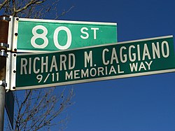
Street sign for Richard M. Caggiano 9/11 Memorial Way - Richard M. Caggiano 9/11 Memorial Way – 80th Street between 10th and 11th Avenues. Caggiano worked for Cantor Fitzgerald. On April 14, 2005, Mayor Michael R. Bloomberg signed the bill into law.<ref>nyccouncil.infoTemplate:Dead link Naming Of 45 Thoroughfares And Public Places</ref><ref>{{#invoke:citation/CS1|citation

|CitationClass=web }}</ref>
- Frederick I. Ergang Way – 12th Avenue and Bay Ridge Avenue. Having been raised in Borough Park, he was principal of P.S. 176 at 69th Street and 12th Avenue from 1973 until his retirement in 1998. At the time of his retirement he had the second longest tenure of any educator in the city of New York.<ref name="New York City Council">{{#invoke:citation/CS1|citation
|CitationClass=web }}</ref><ref>CB10 OKs 'Ergang Way,' 15 others Template:Webarchive "THE BROOKLYN PAPERS" Page 5. March 27, 2004</ref> On May 5, 2004, Mayor Michael R. Bloomberg signed the bill into law.<ref name="ReferenceA">{{#invoke:citation/CS1|citation |CitationClass=web }}</ref>
- Det. Frank P. Collins Avenue – 72nd Street and 7th Avenue. Collins was a sergeant in the United States Army, where he toured Bosnia, and an officer with New York City Police Department, working as a narcotics detective in the 63rd precinct. He died in a motorcycle accident on June 12, 2002.<ref name="New York City Council"/> On May 5, 2004, Mayor Michael R. Bloomberg signed the bill into law.<ref name="ReferenceA"/>
- Giuseppe "Joe" Papandrea Way – 86th Street between 15th and 16th Avenues. Born in Calabria, Italy, Papandrea immigrated to Brooklyn. A leukemia survivor, he was killed by a hit and run driver on this block on January 29, 2002.<ref name="New York City Council"/> On May 5, 2004, Mayor Michael R. Bloomberg signed the bill into law.<ref name="ReferenceA"/>
- De Russy Drive – Circular drive in front of the Dyker Beach Golf Course Club House, connecting 7th Avenue with 86th Street. From approximately 1870 to 1930, an earlier 'De Russy Street' ran within this same parcel, as the northernmost section of the golf course was 92nd Street. This street ran perpendicular to 86th Street and some Template:Convert west of 11th Avenue and it was demapped when the park was expanded northward in the 1930s. Both the Dyker Heights Civic Association and the Dyker Heights Historical Society were instrumental in the naming of the street after General Rene E. De Russy. It was redesignated in July 2009.<ref name="brooklyneagle.com">Dyker Beach Golf & Catering Hall Ribbon Cutting Ceremony Template:Webarchive, Brooklyn Eagle, 07-09-2009</ref><ref>Path Through Park Given Name of 1800s General De Russy Template:Webarchive, Brooklyn Eagle, 07-09-2009</ref><ref>'De Russy Drive' makes its official debut Template:Webarchive, Bayside Times, 07-09-2009</ref><ref>General DeRussy Individual Honoree Document and Figures Template:Webarchive, DykerHeightsCivicAssociation.com</ref>
- Walter L. Johnson Corner – 82nd Street and 11th Avenue, southwest corner. Johnson developed Dyker Heights in about 1895 to 1905. This was the corner on which he built his house, the first at Dyker Heights. The Dyker Heights Civic Association, the Dyker Heights Historical Society, and Council Member Vincent J. Gentile, of the 43rd district, were instrumental in the naming of this corner.<ref name="legistar.council.nyc.gov">{{#invoke:citation/CS1|citation
|CitationClass=web }}</ref><ref>Council passes five local street renaming Template:Webarchive yournabe.com Thursday, December 31, 2009</ref><ref>Council passes five local street renamings Template:Webarchive yournabe.com, Thursday, January 14, 2010</ref><ref>Dyker Heights' Founder To Be Honored With Street Corner Name Template:Webarchive Brooklyn Daily Eagle, by Harold Egeln January 18, 2010</ref> On December 28, 2009, Mayor Michael R. Bloomberg signed the bill into law.<ref name="ReferenceB">{{#invoke:citation/CS1|citation |CitationClass=web }}</ref>
- Hank Vogt Way – at the intersection of 85th Street and 7th Avenue. In 1974, Vogt established, and became the first chair of the Bay Ridge Ambulance Volunteer Organization. He was also Parade Chairman of the Ragamuffin Parade for many years as well as chairman of Planning Board 10. Council Member Gentile helped secure the corner's redesignation.<ref name="legistar.council.nyc.gov"/> On December 28, 2009, Mayor Michael Bloomberg signed the bill into law.<ref name="ReferenceB"/>
Churches
- Shrine Church of Saint Bernadette (Roman Catholic)<ref>{{#invoke:citation/CS1|citation
|CitationClass=web }}</ref>
- St. Rosalia-Regina Pacis Parish (Roman Catholic)<ref>{{#invoke:citation/CS1|citation
|CitationClass=web }}</ref>
- St. Ephrem's (Roman Catholic)<ref>{{#invoke:citation/CS1|citation
|CitationClass=web }}</ref>
- St. Philip's (Episcopal)<ref>{{#invoke:citation/CS1|citation
|CitationClass=web }}</ref>
- Lefferts Park Baptist Church (Independent Baptist)<ref>{{#invoke:citation/CS1|citation
|CitationClass=web }}</ref>
- St. George (Coptic Orthodox) Church of Brooklyn.<ref name= "St. George" />
Park and golf course
Southwestern Dyker Heights contains the Dyker Beach Park and Golf Course, a public park and a municipal, 18-hole,<ref>Dyker Beach Golf Course Brooklyn, NY Template:Webarchive American Golf</ref> championship golf course.<ref>Template:Cite magazine</ref><ref>Template:Cite magazine</ref>
Notable residents
Notable current and former residents of Dyker Heights include: Template:Category see also
- Scott Baio (born 1960), actor<ref>"Wa, wa, wa! Scott Baio comes home Template:Webarchive", Bay Ridge Courier, October 11, 2007</ref>
- Maria Bartiromo (born 1967), television host<ref>Atkinson, Claire. "Maria Bartiromo heading to Davos" Template:Webarchive, New York Post, January 5, 2014. Accessed February 4, 2017. "Meanwhile, the former Money Honey has been busy tweeting photos of place settings at a White House dinner party, holiday lights in Dyker Heights, Brooklyn, where she grew up, and a few promotional re-tweets for her new colleagues at the Fox News Channel."</ref>
- Anthony Fauci (born 1940), Director of the National Institute of Allergy and Infectious Diseases and one of the lead members of the White House Coronavirus Task Force regarding the COVID-19 pandemic grew up in Dyker Heights, above his family's neighborhood pharmacy.<ref>Template:Cite journal</ref>
- Arnaldo Ferraro (born 1936), politician who served in the New York State Assembly<ref>Fried, Joseph P. "State Senate District Sees Brawl Within the G.O.P.", The New York Times, September 4, 1994. Accessed December 30, 2023. "'I am running for the State Senate with the endorsement of people who represent something in the Republican Party,' said Arnaldo A. Ferraro, who is seeking to oust Robert J. DiCarlo from the Senate seat.... Two-thirds of the district's residents live in the Brooklyn portion, as do Mr. DiCarlo, 37, from Bay Ridge, and Mr. Ferraro, 59, from Dyker Heights."</ref>
- Wenjian Liu (1982–2014), NYPD officer, died in a 2014 shooting of NYPD officers
- Adam Ottavino (born 1985), baseball pitcher for the St. Louis Cardinals, Colorado Rockies, New York Yankees, Boston Red Sox and New York Mets.<ref>{{#invoke:citation/CS1|citation
|CitationClass=web }}</ref><ref>{{#invoke:citation/CS1|citation |CitationClass=web }}</ref>
- Joe Rollino (1905–2010), an original Coney Island Strongman<ref>At a Mighty 104, Gone While Still Going Strong Template:Webarchive New York Times by Manny Fernandez and Michael S. Schmidt, January 11, 2010</ref><ref>Famed Coney Island strongman Joe Rollino, 104 (aka 'Kid Dundee') killed after minivan hit Template:Webarchive New York Daily News' by Jill Colvin, Rocco Parascandola and Corky Siemaszko, January 11, 2010.</ref><ref>Bay Ridge Accidents Kill Three Victims, Including Man, 104 Template:Webarchive Brooklyn Eagle by Raanan Geberer January 11, 2010</ref>
- Gregory Scarpa (1928–1994), caporegime and hitman for the Colombo crime family, who was an FBI informant<ref>Raab, Selwyn. "The Mobster Was a Mole for the F.B.I.; Tangled Life of a Mafia Figure Who Died of AIDS Is Exposed", The New York Times, November 20, 1994. Accessed December 30, 2023. "Inside the Mafia, Gregory Scarpa Sr. could have served as a role model for ambitious gangsters.... On Dec. 29, 1992, near his home in Dyker Heights, Brooklyn, he was shot in the left eye in a gun battle over a narcotics deal and his bail was revoked."</ref>
- Rosanna Scotto (born 1958), TV news anchor, grew up in Dyker Heights.<ref>D'Arienzo, Sr. Camille. "New York TV news anchor talks of life off-camera" Template:Webarchive, National Catholic Reporter, May 15, 2012. Accessed February 4, 2017. "[NCR] Where did you spend your childhood? [Scotto] Growing up in Dyker Heights, Brooklyn, was great."</ref>
References
External links
- Pages using infobox settlement with the wikidata parameter
- Pages with broken file links
- Dyker Heights, Brooklyn
- Little Italys in the United States
- Neighborhoods in Brooklyn
- Populated coastal places in New York (state)
- Sicilian-American culture
- Italian-American history
- Little Italys in New York (state)
- Italian-American culture in New York City